Thursday, June 25, 2020

20200621 BNSF Shoofly and Crossover Replacement

I misread a road closure report and thought they were closing lanes by the BNSF overpass of I-294 replacement work starting at 7pm, Sunday, June 21, 2020. So I went over to check it out.

Actually, these first five photos were taken by my wife on June 18, 2020, in Downers Grove. Some track panels that had been stored in the DG Yard were headed west. That is why I was checking the toll road lane closures in the first place.


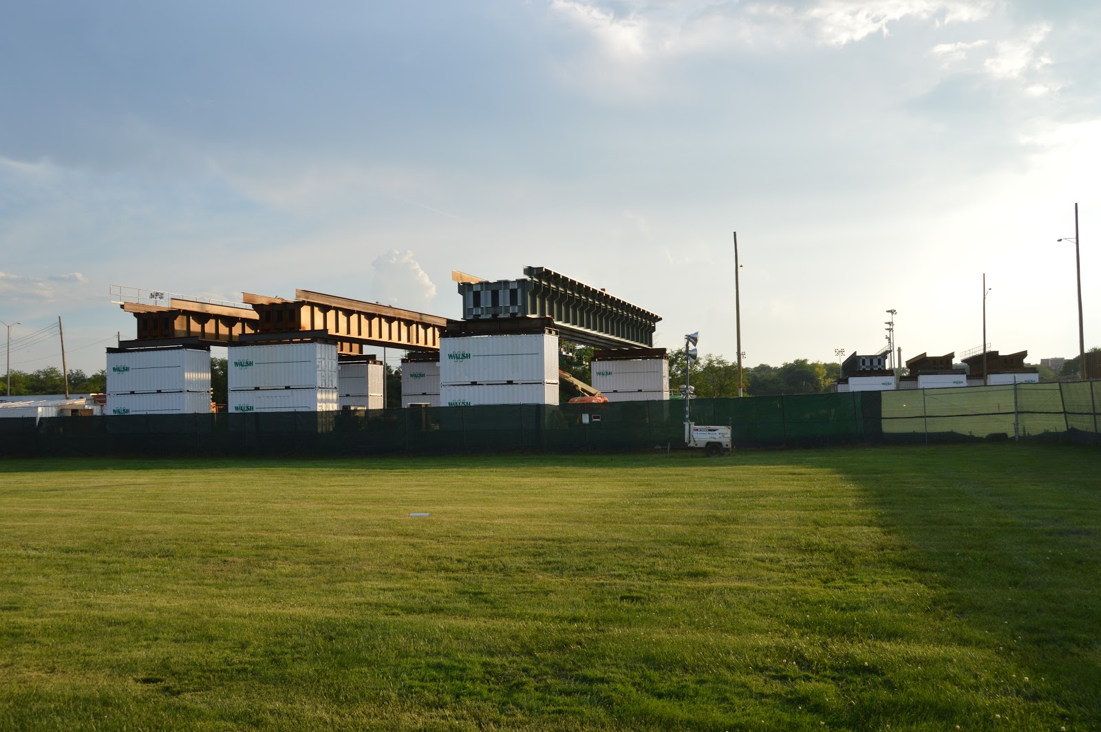
From a vantage point in Hinsdale Veeck Park, it is obvious they are prebuilding the spans for the shoofly. (The trees you see on the Satellite image have been removed from the south side of the tracks.) These three are on the west side of the tollway.


Now I'm looking through the chain link fence along the 47th Street Bridge.


They are building three spans on the east side as well.


Walsh Construction has quite a few "yellow critters" in the area. And I need to get better at overriding the auto-focus on the camera.

(new window)
20200621  I was on the 47th Street Bridge taking photos of the construction of the shoofly when an inbound commuter crawled by. I took a video because it was going so slow. The tollroad, when the announced the overpass replacement, bragged that the shoofly would support the track speed of 70mph. So why are the trains going so slow while the shoofly is being built? This was a Sunday evening and no work was happening. Furthermore, it shouldn't be a work zone because the train never honked going pass here.
Later, I caught an outbound that was also going slow, but it never honked a warning for a work zone.


Another view of the three spans on the west side of the tollway.

An overview.

Now I'm driving down Burlington Ave. I stopped to get a photo of the ramp that they built since I was here May 6, 2020.

A view of the side of the ramp that they built since May 6.

A view of the work area from an opening in their gate.

I zoomed in on the spans they are prebuilding, but something went wrong with the autofocus. This is the first time I've seen a failure mode like this in the camera.

I found a gap in the construction fence a little further south of the previous photo.

They had piles stored in this area on May 6. Now they store their crane and some of their yellow critters here.

The three spans on the left are on this (east) side of the tollway and the three on the right are on the west side of the tollway.

It looks like they now have the abutments on both sides and the pier in the middle done.

I walked around taking some closeups of the eastern spans. Since they are being built on top of three containers, the construction fence doesn't block my view.


An old and new commuter coach were at the end of the train. I never noticed a car with the bigger windows before.

It is my understanding that if a car says "BNSF Railway" on the side, they are part of the oldest order that is still running. Since they seem to be buying new cars, these may be disappearing.


When I was leaving along Burlington Ave., I spotted this track construction.

A view looking the other way (west) to provide context for the construction area.

An overview that includes a couple of loose rails. The lettering in the white area is "141-New" "NORTRAK" and "132-1/4" LOSS".

Some closeups of the power turnout.


When I saw the gaps in the ties is when I realized that they have yet to construct the power frog.


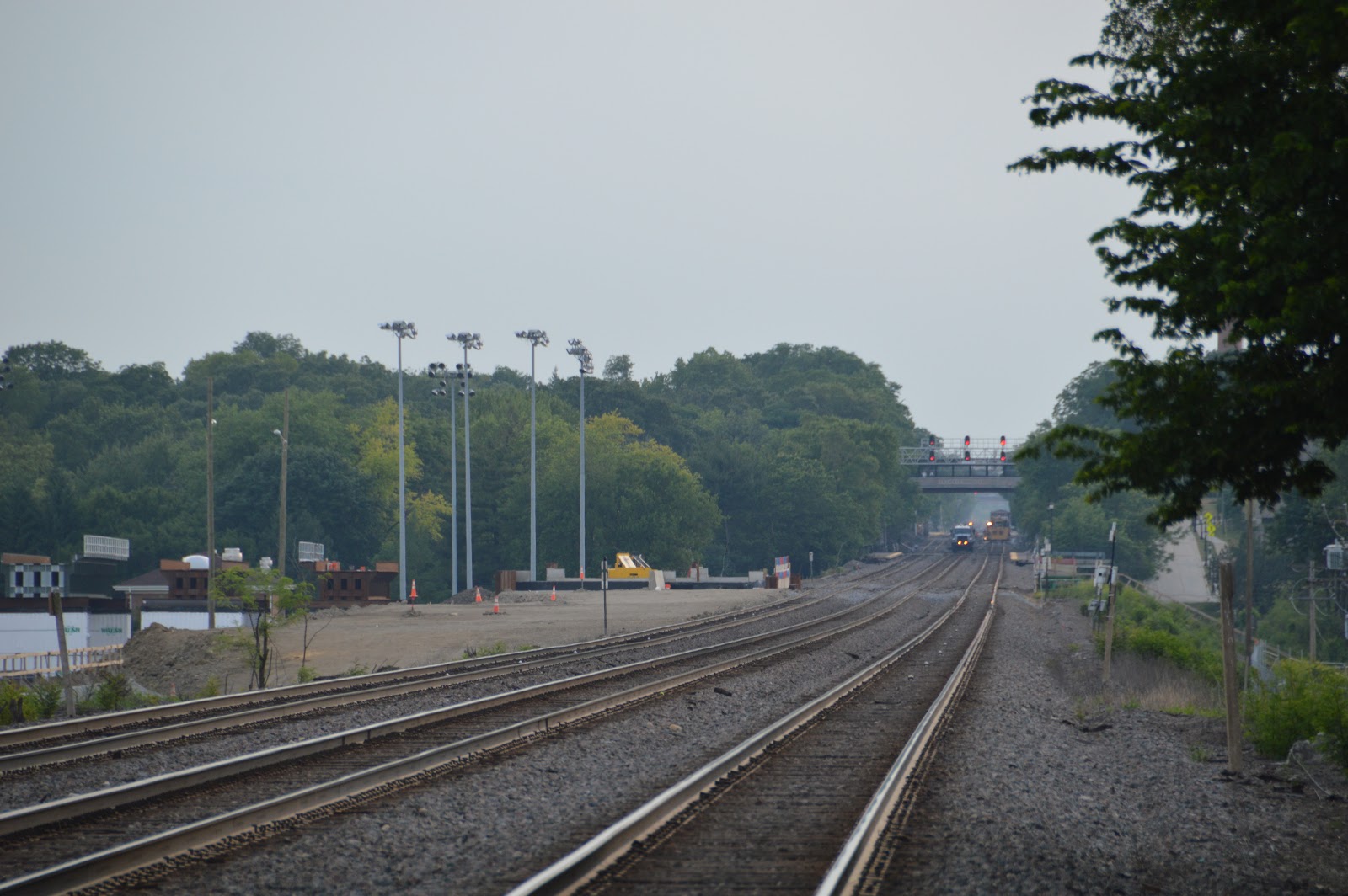
Zooming over the ramp and looking West to note the MoW equipment that was replacing crossovers west of Oak Street Bridge.


From a crosswalk at Central Ave.
The tollway is supposed to leave the park better than they found it.

I've never seen the south side of the Highlands Station before. I never realized how hilly it was in this area. The station really is on high land.

1997 Hinsdale Quadrangle @ 1:24,000
Some shots from the platform area. Looking West.

They have a crosswalk between the platforms. The relatively new PTC signals and Oak Street Bridge.

Looking East.

Looking West again.

A view of the shoofly construction from the far east end of the south platform.

Discarded ties at the end of the platform.

I heard a train honk.
(new window)
20200621 While I was on the east end of the south platform of the BNSF Highlands Station taking photos of the I-294 shoofly construction, I saw an e/b freight rolling past the crossover replacement work that was happening west of the station. I started the video before I normally would to catch the honking in the work zone. Thus the shaky zoom. Sorry about that. I had to turn up the volume during playback to hear the horn because the engineer was careful to be gentle with the horn. I imagine Hinsdale is the type of town that generates complaints when a train honks the horn. At 1:12, I start a clip of the rear end because, as I was walking down the platform to get back to my van, I thought the train was speeding up since it was past the I-294 work zone. But then I wondered if it just seemed to be going faster because I was feeling wind turbulence as I walked down the platform. The Highlands station forces one to stand a lot closer to a moving train than I normally would. I noticed that the train had switched from continuous double-stacks to trailers. It was interesting how you could feel the good and bad aerodynamics of a modular train. https://industrialscenery.blogspot.co... At the end, I zoomed in to the tamper that will finish the crossover replacement work.


The parking lot south of the Highlands Station was closed because of sewer work. (An advantage of Sunday trips is that I parked there anyhow.)

A view of the crossover work from the Oak Street Bridge. The turnout in the lower left corner is a new one because it has a power frog and a smaller angle for a faster speed limit.

I saved an image of the old arrangement because it looks like they are changing it.
Satellite
Another advantage of doing the trip on Sunday is that I could part in the parking lot of the Village of Hinsdale Water Plant.
I headed east down Symonds Drive taking photos.


A train happened to come through while I was there.
(new window)
20200621 While taking photos of a BNSF crossover replacement project west of Oak Street in Hinsdale, IL, a train came through. I started the video early because the train was already honking for the work zone. (It is a lot easier to railfan when they have to honk because it gives me time to get the camera ready.) While the locos were rolling past, they fired up the tamper. So I continued to let the video suck battery because I now carry a spare. I continued videoing after the train finished until it became obvious that a repair, not just an adjustment, was needed. I spent almost another half-hour taking photos of a Brandt truck with six ballast hoppers and some city water pipe work in the area. And the only change by the tamper was that it has some maintenance trucks parked next to it and I ran out of daylight.


Going back west along Symonds Drive. I've never seen a Stanley TracHorse before. Obviously, it is a mobile hydraulic power supply. The BNSF tools such as the cutoff saw, power wrench, weld shear, grinder, etc. use hydraulic power. But every big truck I've seen has one or two hose reels for a hydraulic circuit.

On this trip, I saw new turnout machines east of the tollway and old ones west of the tollway.

Main 1 is closest to me (north side). I'm trying to capture that #3 is higher than #2, which is higher than #1. I've never seen this before on The Racetrack.


Someone was sitting in the ballast regulator waiting for the tamper to be fixed.
I knew I was getting low on daylight, but I had the ISO cranked up to 800 and I thought the camera would do a better job than this. The close headlights are the ballast regulator and the further headlights are the tamper. (There is a cross walk here. Why can't Downers Grove have one across from Gilbert Park??? Hinsdale has at least two and Western Springs has at least one and they are getting an underpass.)

A track panel ready to replace a turnout.

This Brandt truck was pulling six ballast hoppers.


The yellow critter on this side of the tracks was a road grader. I don't know whose it was or what it was doing in the area.


They are Symonds Drive between Post Cir and N Park Ave boring a hole under the tracks and Chicago Ave to S Park Ave.


I think they dug this hole just to verify the depth of the existing utilities is above where they will be boring the new hole. I've seen "verification holes" like this before for horizontal drilling projects.
Digitally Zoomed
This photo was taken from south of Chicago along Park. I believe this is their target for the bore.

Back on Symonds Drive. That is my van on the right. The main purpose of this photo is to record the various sizes of pipe. I don't know if they are supply or sewer or both.

These parts would be supply.

But this looks like sewer.

(Facebooked)

Saturday, May 30, 2020

blogger link bug

I used the new blogger to copy and paste the paragraph below from https://industrialscenery.blogspot.com/2020/05/steelworkers-park-and-blast-furnace.html

The edit session I was copying from had the URL
https://www.blogger.com/blog/post/edit/7577633936396294153/6051734377700828924


The southern park has been developed as Steelworkers Park. Read this page (update: the 2016 link is now broke. I'm glad I summarized the essence of the page) from the bottom to the top to learn how enough mud was moved from the bottom of Lake Peoria 168 miles downstream to create 4-feet of top soil to turn the slag fields into desirable vegetation. Also "biosolids" from the MWRD drying fields were used to help convert the land so that it could sustain plant life. (more update: I did find some new links about putting soil on top of slag: blog and technical report.)


Every hot link in that paragraph has the URL of the edit session rather than the URL I created it with. This screenshot after I click the "biosolids" link is an example of the wrong URL.


Below is the paragraph copied using the old version.

The southern park has been developed as Steelworkers Park. Read this page (update: the 2016 link is now broke. I'm glad I summarized the essence of the page) from the bottom to the top to learn how enough mud was moved from the bottom of Lake Peoria 168 miles downstream to create 4-feet of top soil to turn the slag fields into desirable vegetation. Also "biosolids" from the MWRD drying fields were used to help convert the land so that it could sustain plant life. (more update: I did find some new links about putting soil on top of slag: blog and technical report.)

This screenshot shows that it contains the expected URL content.


This bug puts my complaints about the inefficiency of using the new URL in perspective. I made those comments with the mind set that the guts of the URL code would at least work correctly. I have had my opinion of the Blogger software readjusted. This is the second bug I hit on May 30. I've already reported the bug of missing labels in the label menu. And I'm not using the new version heavily because the photo insertion is intolerable and because I haven't figured out how to find unlabeled posts. Imagine how many bugs I would find if I was using it heavily. Did you guys do any testing before you told the public they better try using it????

I need to be able to correctly cut and paste blog text because I do that for various reason:
1) to make a temporary backup copy.
2) to rearrange the photos in a post to put them in chronological order or some other order that becomes obvious after a few years of adding photos to the post.
3) to create new posts by moving content from one or more existing posts and then adding some new material. For example, I used to have one post for all of the Chicago railroad passenger stations. A couple of years later, I wrote a post for each of the six major stations and rewrote the original post to be an overview. Another example of a post being busted up into several posts is Griffin Junction. I cut and pasted a lot of content for both of these rewrites.


Monday, May 18, 2020

May 2020 version of US Steel: South Works

(The information about the Steelworkers Park has been removed from the newer version because it was moved to the Steelworkers Park notes.)
C. William Brubaker/UIC Digital Collections, 1969, CC BY-NC-SA 2.0
Looking northeast along the Calumet River near its mouth at Lake Michigan.
The local pioneer in this field [producing rails] was Eber B. Ward, who used part of a fortune made in the Great Lakes shipping business to build Chicago's first rail-rolling mill in 1857. Located on the North Branch of the Chicago River, Ward's plant was known as the North Chicago Rolling Mill Company. By 1860, when it employed about 200 men, it already ranked as one of the city's biggest enterprises; a decade later, it had expanded into a very large facility with 1,000 workers. In 1865, this mill experimented with rails made out of Bessemer steel ingots—the first such rails produced in the United States. At the beginning of the 1880s, Ward's company opened a sister mill at the mouth of the Calumet River on Chicago's South Side—the famous South Works. (ChicagoHistory)
C. William Brubaker/UIC Digital Collections, 1969, cropped, CC BY-NC-SA 2.0
Looking northeast from Lake Michigan at East 95th Street.
Note that automobile freight cars were still uncovered in 1969.

1938 Aerial Photo from ILHAP, north of slip
1938 Aerial Photo from ILHAP, north of river
The South Works began when North Chicago Rolling Mill Co. bought 73 acres of land "with 1,500 feet of frontage on the Calumet River and 2,500 feet on Lake Michigan and broke ground for what would become the first integrated rail mill in the world." Over the decades it expanded the area by dumping refuge from both their north and south works until they reached 576 acres and by 1933 the land was filled with buildings. "By the early 1980s, plant closure was certain after a major planned expansion was cancelled. Within 22 years starting in 1970, the Works changed from a major steel operation with a rated annual steel capacity of over seven million tons and more than 10,000 employees to a plant with a capacity of only 44,000 tons and 690 employees at its closing in April 1992. Massive demolitions were well underway." 1983 and 1994 aerial views of the site (DavidSchalliol) I've seen numbers as high as 20,000 employees at this works.

I remember reading an article in the Tribune decades ago about a new rail manufacturing plant planned for the South Works. I assume that was the "major planned expansion" referred to above. Reading "Concessions at South Works: What Price a Rail Mill?" made me appreciate the significance of the 5 production workers helping the 3 maintenance workers as emphasized in a video of the hot roll mill in Riverdale, IL. Also note that a large steel facility employees just 8 people.

The plans to build a better route for US-41 using the new vacant land have been realized. But I'm disappointed that it is not limited access. When they finally do fill that land up with condos and retail outlets, the intersections will become a bigger problem.
The plans for some parks have been completed. (Steelworkers Park?) Read this page (update: the link is now broke. I'm glad I summarized the essence of the page) from the bottom to the top to learn how enough mud was moved from the bottom of Lake Peoria 168 miles downstream to create 4-feet of top soil to turn slag fields into desirable vegetation. Also "biosolids" from the MWRD drying fields were used to help make land that could sustain plant life.

Albert Bartkus posted a CBS CHICAGO link which includes this photo
credited to Chicago Lakeside of the proposed redevelopment
The plans for residence and retail space as well as a new marina are still just drawings.

Forgotten Chicago has some more "then" and "now" pictures.

Update: 1920s aerial view of the railroad yards with the steel plants in the background. Pictures of EJ&E Bridge 710 also have views on the South Works on the left side.
Frank Smitty Schmidt posted
US Steel South Works in 1920
Bob Lalich I believe this photo was taken prior to WWI. The south slip seen here was expanded in 1917.
Frank Smitty Schmidt Title: U. S. Steel Railroad Yards at South Works c1920s
Contributing Institution: Pullman State Historic Site
Collection Name: Industrial Heritage Archives - Southeast Chicago Historical Society

Description: Aerial view of South Works in the late 1920s looking north from southeast corner of mill. Image shows railroad cars, life saving station at lower right, factory buildings in background, residences and neighborhood street at left.
Kevin Piper posted
EJ&E was an early slug user on blast furnace highline jobs. NW2 441 and T-3 have a cut of coke hoppers at the long gone USS South Works in Chicago on 1-25-80.
Kevin Piper posted
This is a view of the USS South Works in Chicago. That's a green & orange EJ&E SW1 switching cars in the foreground. PHOTOGRAPHER UNKNOWN
Kevin Piper posted
This is an excellent view of the USS South Works main blast furnace area, ore bins, high-line, and powerhouse (upper left.) The view looks southeast towards Indiana. Some of the blast furnaces pictured here were operational until the early 1980's. EJ&E RY PHOTO
Dennis DeBruler Two big blast furnaces, two smaller ones, and maybe a fifth one.

Kevin Piper posted two photos with the comment:
EJ&E T-3 and 441 are about to shove coke hoppers up the blast furnace high-line on 1-25-80. If you look closely, in the distance is the 86th Street entrance to the mill. There was a bar right outside the gate where EJ&E switch crews would head for "beans." Old Style on tap flowed freely there all day. (441) KEVIN PIPER PHOTO/(Gate) EJ&E RY PHOTO
1

2
Kevin Piper posted
This is an interesting view of the South Chicago mill taken in February 1941, on the eve of World War II. This is looking east at 90th & Avenue O. The blast furnaces in the distance were later removed after installation of the electric furnace. Note the string of EJ&E roofless boxcar coke cars just beyond the fence. As a child, my grandfather who lived in this neighborhood, would climb under the fence and steal coal here for his family.
Kevin posted again
Steve Malachinski Those are the old side blast furnaces along the south dock. only 3 were in operation prior to 1980 #3 #5 and E being small furnaces they only put out maybe two ladles of iron per heat.

Bob Lalich The photographer was Charles Cushman. He took extensive photos of steel mills in the Calumet region, among other subjects. Fortunately his collection has been preserved for those of us interested in history. http://webapp1.dlib.indiana.edu/cushman/index.jsp
duniayote

Kevin Piper posted
I returned to the USS South Works by accident in 1987 as a Chicago Rail Link employee. We interchanged cars with EJ&E in the mill by way of South Chicago Junction on Chicago Short Line and BRC trackage rights. By then the mill was still intact, but very devoid of human beings inside. I always had an eerie feeling going in there. I remembered the tracks from my EJ&E days, and had some fun once by taking our CRL locomotive "around the horn" to the north end by the lake and along 79th Street then back south along Brandon Avenue. We sure would have had some explaining to do if we derailed way up there! My biggest regret was not getting any photos, since there was still plenty to see. This is USS Baldwin DS4-4-750 20, and an EJ&E SW1200, taken with a telephoto lens from Burley Avenue on 5-25-86, about a year before my return. LEON KAY PHOTO
Bryan Howell Mill had its last heat in 1993. My grandfather was a millwright until they closed and then was hired to work on the clean up operation.Joe Zeller I can see the nose of another engine, behind that bldg to the right. Maybe?Kevin Piper That is VO-1000 21.
Tony Margis posted
View from the beach back in 1973.
Tony Arduino posted four photos with the comment: "Need help...are these photographs of US Steel South Works or Gary Works? Year unknown. Photo by Calumet Studio on 106th St. Is this photograph at the museum?."
[Some comments indicated Gary, but the consensus, and I concur, is South Works.]

1
U. S. Steel South Works. EJ&E RR swing bridge near bottom left. South Slip is visible. Youngstown is gone and taken over by the Port District. Probably c 1970.

2
South Slip and railroad yards.
Bob Lalich It appears that #8 blast furnace was still under construction in the top left corner of this photo. It was fired up in August of 1970.
Dan Ess shared a link
South Works, 20.11.58
Photo from Charles W. Cushman collection.

3
Rod SellersRod manages the membership, moderators, settings, and posts for Southeast Chicago Historical Society. Port District facilities at Iroquois Landing.
George Dosen Transoceanic Terminals. Probably early to mid 60's
Rod SellersRod manages the membership, moderators, settings, and posts for Southeast Chicago Historical Society. Youngstown ceased steel making at the Iroquois Landing site around 1960. The steel maker still owned the land which was leased to Iroquois Terminals Inc.
[It is nice to know that the Calumet River used to see a significant number of "salties" (international) ships.]

4


Rod Sellers posted a photo of the Acme blast furnace that was still standing in 2004.
This is one of several photos documenting the saving of some artifacts in Pullman then moving them to a Steelworkers Park near the iron ore storage wall.

Dennis DeBruler posted two photos with the comment:
Mike Kieltyka created a photo album, https://www.facebook.com/groups/120664941289363/permalink/1822240367798470/, concerning the Structural Division of the USS South Works. I selected a couple of photos that illustrate how important railroads were for industry back when we had industry. The first photo is an aerial view showing the railyard by the lake and the many spurs into the buildings. The second one shows "52-inch carloads ready for shipment."
Rod Truszkowski Dennis DeBruler you can't put residential on the land too polluted it would make a great place for a casino/ hotel /arena site with park land along river and lake even the Obama library would work there and help the area.
Dennis DeBruler
You and 1 other manage the membership, moderators, settings, and posts for Chicago Railroad Historians. The plan I read about included houses. Maybe that is why the plan did not work. They hauled enough mud from the bottom of Lake Peoria to cover a slag field 4-feet deep to make a park, https://industrialscenery.blogspot.com/.../us-steel-south...
Rod Truszkowski A good deal of the "LAND" the mill is built on is slang and byproduct from the mill the city and state let them fill in the lake front numerous times. The park across the river is also fill from the mill. A good deal of the old mill properties are toxic. One spot in the old Wisconsin steel plant is so bad they "cleaned " it up wearing suits and air tanks, black topped it, and then fenced it in. No trespassing signs everywhere
Rod Truszkowski Railroads used to use slang because it was cheap they used it when they built the last C&WI bridge over the Cal river then they found out it was toxic so they stopped using it
1

2

Rod Sellers posted
Where am I?
Mark Simunic I think that is the lifesaving station across the slip from the blast Furness at South works.

Bill Staniec commented on Rod's post
Here is where it was. Next to South Works, South Slip.
Look at all the boats waiting their turn.

Rod Sellers commented on his post
Exterior view of U. S. Life Saving Service (predecessor of the U. S. Coast Guard) located near the mouth of Calumet River, next to the south slip of U.S. Steel Plant 1963. This property is still federally owned and never was part of U. S. Steel as seen in this 1941 map.
Bob Victor Rod Sellers - The original Coast Guard Station was later used by the Army Corps. of Engineers when the picture was taken. From USCG files. Coast Guard Station Calumet Harbor is located on the southern end of Chicago's lake front in Calumet Park and was originally placed into service in 1933 as Station South Chicago. Before that, the previous station commissioned in 1915, was located on the north bank of the Calumet River, just inside the river's mouth. In a continued state of growth, the present station has undergone two renovations: the addition of floating boat docks and three mobile homes.

MWRD posted
A view of Harbor Ave/Lake Shore Drive to the northeast from Mackinaw Avenue in Chicago on September 7, 1923, taken during construction of a portion of the Calumet Intercepting Sewer along Harbor Ave.
Mike Girdwain The concrete sidewalks are nicer than today. The street is about the same, lol.Jan Erkenbrack Selling potatoes.
And the sign says Buffet Breu on draught. Which was how we spelled draft back then.

Bob Lalich shared

John Domansky Sr.
Mike Crowley Actually that is looking east at the south slip at South Works. The 14&E blast furnaces in back ground.
Bob Lalich Yes, looking east from 90th St.
[Street View]

Steve Vanden Bosch posted three photos with the comment: "This photo from the Library of Congress 4a0608u shows an unidentifed Whaleback Steamer at Illiniois Steel Works South Chicago in the 1900's."
Alex Parker It looks like the Pathfinder later known as the Progress.
Built 1892. Scrapped 1934
https://www.flickr.com/photos/upnorthmemories/9568154939[Illinois Steel Works was one of the companies JP Morgan bought to create US Steel.]
1

2

3


There is a 1965 map and an aerial photo in ejearchive. If I understand a copyright complaint correctly, I'm not supposed to provide URLs to information. So happy hunting.

Comments on postings of the map by another person:
Dennis DeBruler I wonder when the swing bridge was replaced by the lift bridge.
Ron Harris Along about 1975

Kevin Piper South Works wasn't just about steel. It was about people, neighborhoods, and Chicago. It was about America. There were over 20,000 people employed there during the 1970's. The ethnic blue-collar neighborhoods supporting the mill were pure Chicago. African-American, Polish, Italian, Irish, they were tough, hard-working folks, who often worked dangerous and dirty jobs, making the steel that helped build America and its economy. South Works is about a time in American history that is now gone forever. 

There was a Greek joint near the north gate that served the biggest and best Gyros I ever ate. A new automated rod mill went on-line in 1975. In 1980, plans were being made to produce new continuous welded rail at South. This could have saved the mill. Cheaper foreign rail flooding the U.S. market, plus a weakening economy dashed those plans. It meant something to be employed at "Da Sout-Werks." 

South Works was mainly a structural mill. Mostly I-Beams, rods, and plates. No coils, wire, sheets, or tinplate here. During the 1980's, all blast furnaces were shut down for good, and steel was produced with scrap melt from a newer electric furnace. The mill closed in 1993.
Bob Lalich Kevin Piper - rails were produced at South Works also.
Mark E. Vaughan Then did the bridge 710 which is between the Laborers Dorm and the Yard Office take the line back to Kirk Yard? Did the tracks stub NW of the engine service facility and the roundhouse or did the travel farther off the map?
Bob Lalich The tracks connected to the IC and B&O west of what are labeled Yard C and E on the map.

Comments on postings of the aerial photo by another person:
A very detailed satellite photo of South Works. By the 1970's, about 2/3 of the structures located below the ship slip in the center were removed. The high-line storage yard in the 9 o'clock position later became a large paved EJ&E employee parking lot. The curvy south blast furnace high-line can be plainly seen cutting through the lower center portion of the photo. This long and steep structure was especially spooky at night. The big 89th Street foot bridge over the Train Yard was also gone by the '70s.

Bob Lalich I believe this photo was taken during the strike in 1959. Note the complete lack of smoke.


Workers leaving the plant.