 |
| 20180708 2774 |
 |
| Satellite |
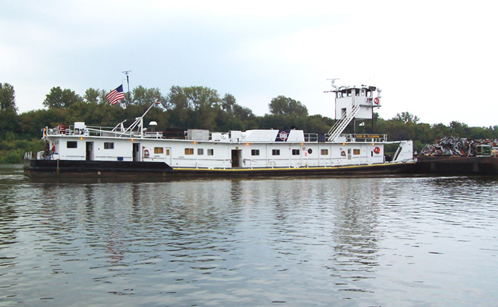
Sam M. Fleming
0590071
Length 144 feet - Breadth 35 feet - Twin Screw GM 12-645E7B, 4300 hp
Built 1977 by Nashville Bridge Co., Nashville, TN Falk red. 4.48:1. Kort nozzles.
Retractable pilothouse
Originally William F. Earthman
Renamed Sam M. Fleming 1995
Owned by Ingram Barge Co., Nashville, TN
I discovered that he got this information from TowBoatGallery. That is good to know. I looked at several web sites to find information. Most of them claimed to be tracking sites, but the data was way out of date. One was as old as January!
I noticed in Joseph's photos that Sam displays the Ingram logo whereas in my photo it displays Inland Marine Service, but it is still listed on the Ingram web site. Gary Whittington also caught it on the Ohio River with the Ingram logo at Paducah, KY.
A retractable pilothouse for a line haul pushboat is rather rare. It has such a long deck house because the living quarters for tow crews have to be included in that deck. Normally a line haul pushboat has several deck levels and the higher levels have the captain's quarters, galley, bunk house, etc. I wonder were else on the inland waterways there is a height restriction of about 16.5' to justify a low-profile line haul pushboat. Because of their very distinctive profile, I have found two more to research: Mr. Chuck and Ned Merrick.
 |
| Satellite |
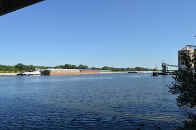
Between the parking lot and the river was a heavy treeline. But then I discovered a concrete culvert that created a gap in the treeline so that I could get this shot.
 |
| 20180716 2877 |
But I could not tell if it was three barges wide at the middle and rear. If it was, then the starboard barges were loaded barge and did not have covers because I could see them in the photo if they were empty and/or had covers.
The significance of the starboard rear spot being empty is that the pushboat could move into that spot when going through a lock.
I went down the road to the loading dock on the west side of the casino to see if I could get a better view of the pushboat. Given that the following are the only two views I could find, the answer is no.
Next I took my camera into the visitor center, which a sign at the gate forbids. I wanted someone to come out to talk to me so I could ask when they expected Sam to lock through. No one came, so I took a photo of a little Grove crane at the southwest corner of the lock. (Closeup below)
Since I still wanted someone to come out and challenge me, I took a shot of the 777 as well. It is parked on a barge.
It has been parked there long enough that Google has captured an image of it.
 |
| 3D Satellite |
I repeat the above noonish position that was almost identical to the morning position for easy comparison with later positions.
 |
| Satellite |
 |
| Satellite |
 |
| Satellite |
Before and during most of the day of 20180719, 205.4
I don't see anything on the satellite image at 205.4, but there must be a new loading dock or something because this is the second time I have caught it spending quite a bit of time there, and then it heads back to the Chicago area.
But when I looked at 8:51, it was at milemarker 216.3. So even though a direction icon on their web site still showed that it was downbound, it is obviously headed upbound.
2133: 217.4
2313: 221.2
0034: 225.1
 |
| Satellite |
0224: 226.4 Are they stuck in a queue for Starved Rock all the way back here??
0455: 229
0753: 231 in Starved Rock Lock
1134: 242
1242: 244.3, I happen to notice that the icon has been changed to upbound.
1303: 244.3 Looks like they are waiting for the Marseilles Lock.
2321: 269.4
2354: 270.1
20180721
2255: 278.2 upbound
20180722, I was out of town
20180722
1719: since 0500 it has been setting at 278.2
2209: 271.4, the icon is showing upbound, but the mileage difference indicates downbound
20180724
0008: 269.4, icon is still upbound
0236, 03:52: 266.4
0500: 264.3
1045: 249.1, someone finally changed the icon to downbound
1247: 245.2, it looks like it has been waiting for its turn to go through the Marseilles Lock
1436: 245.3, still waiting for the Marseilles Lock
1830: 233.3, it looks like it is waiting for the Starved Rock Lock
2047: 231, it is in Starved Rock Lock
2142: 230.2, must have gotten out of the lock just a little bit ago
2306: 225.2
20180725
0045: 219.3
0500: 208.5
0711: 209.4, they have an "In port" icon, but it is still showing downbound. Marquis Energy talks about exporting DDGS and eth
anol using the Illinois River, but the satellite image shows Marquis Marine transloading grain from truck to barge. A photo shows transloading barge to truck with a clamshell crane.
1349 198.3, lots of barges being loaded with aggregate. And they have there own little pushboat.
1532: 185.1, so I guess they just happened to be passing by the above aggregates barge loading facility
1823: 174.3, it looks like it might not be coming back to the Chicago area like it did before.
2028: 164.1
 |
20180726
0500: 144.3
1038: 141.2, so why did it take over five hours to go 3 miles? I don't know where the second wickets dam is on the Illinois.
1529: 153.4, So it was at 141.2 for so long because it was getting a new load for Chicago? If so, it must be a new business because I don't see a loading dock on the satellite image.
20180727
0017: 166.5
1403: 205.3
2102: 222.4
20180728
0500: 225
1019: 234.1
2218: 248.3
Obvously, it is not going to make it back to the Joliet by July 29. Since I'm going to be out of town next week, I'm going to quit following Sam for a while because I won't have a chance to chase it in the Chicago area. So it is time to publish this look at Sam's trips on the river.
Update: actually, it looks like it spent some time at Ingram's Channahon fleeting area, then headed downbound. You don't need a retractable pilothouse for that.
20180804 1322: 208.1 on the Upper Mississippi with a downbound icon
20180806 0907: 182.1 after spending a couple days upstream of Alton, it looks like it is headed down the lower Mississippi River. The are now just three boats on the Illinois River, Brian A. Napack is the closest to Chicagoland at 179.
20180807 1718: 194.3 It has been setting here since at least 0500. The icon indicates upbound.
20180808 2255: It has been setting at 194.4 since 0500.
1836: 11.3, it has started back up the Illinois Waterway
20180810
0234: 53.1
0500: 61.1
1117: 80.7
1535: 85.2, just 5 miles in 4 hours? I looked for a lock, but I did not find one.
20180811, stuck at 85.2 or 85.1 all day
20180812 1048, 2124: 85.1
20180813
1708: 85.1
2320: 81.8
20180814
0254: 81.8
2010: 85.1
1843: 85.1
2129: 85.1
20180816 1045: 89
20180817
0018: 124.3
1113: 151.6, lots of tows in this area. A fleeting area?
1452: 151.6
20180818
0711: 192.8
1809: 218.9
2339: 228.6
20180819
1256: 231.8
2137: 255.5
20180820
0500: 245.1
0635: 236.7and icon shows downbound, at ADM Growmark
20180821
0500: 228.3
1034: 221.7, Brian A. Napack (no photo) is at 268.5, but the next day was down to 250.5 with a downbound icon; Marge Mcfarlin (retractable pilot house) is at 278.5, but the next day was down to 221.8 with a downbound icon; five are on the Illinois Waterway. Since I'm out of town, I'm going to quit following the tows for a while.
 |
| Erna E. Honeycutt |
2151: 277.1
20180831
0500: 278.1
1119: 272.1 So it changed tows at the Channahon fleeting area and is heading out of the area. This makes sense sense it is the purpose of a fleeting area to have a tow assembled by local pushboats so the line-haul pushboat has a quick turnaround. The local pushboats will then disassemble the tow and distribute the barges delivered by Erna. When the leaves are off the trees, I'm going to have to make a trip along Front Street to see what I can see.
20180903 1140: Brian A. Napack is the furthest upstream at 251
20180904 At 0500 it was at 278 and at 1808 it was back down to 245.9. So it must have also swapped tows at Channahon.
Marge Mcfarlin is now the furthest upstream at 253.2
20180905 11:47 278.7, but thunderstorms are on the way. Wow, by the end of the day it was all the way down to around 266
20180907 1239: Dale Heller is at Channahon, but it is raining today.


