A couple of highlights of the photos below:


Sam M. Fleming
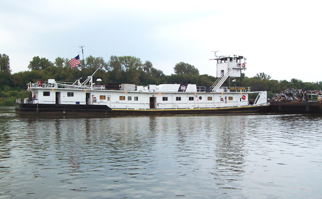
Position: Mile 279.3 on the ILLINOIS WATERWAY
Net Tonnage: 474
Engines: GM 12-645-E7B
Boat Height: 16.6FT (Highest Fixed Point: 42.1FT)
Length Width: 144X35FT
Boat Draft: 10.6FT
Locate this Vessel on Google Maps |
| David Gulden posted WILLIAM F EARTHMAN now the SAM FLEMING |
When I first checked Sunday morning (Jul 8 2018), it was just below Brandon Lock. When I checked after I got up for the day around 1pm, it was just south of US-6 at the Joliet fleeting area. So I wondered if it was dropping off a tow and picking up another to go downbound like I have described for the Leo G. Lutgring. I decided it was worth driving to Joliet to check it out. To make a medium story short, I not only did not see Sam (I recently read that proper usage is to use the first name.) in the fleeting area, I so no barges there.
After stopping to take some photos of the completed new Joliet train station, I noticed in the distance that the blue Ruby Street Bridge was up. So I quick headed to that bridge to see if it was approaching the CN/EJ&E Bridge. I did not see the tow upstream.
 |
| 20180708 2737 |


 |
| 20180708 2743rc, looking North You can see a downbound tow on the right passing "double parked" barges on the left. We will see much more of that downbound tow shortly. |
 |
| Looking South The small 1x1 downbound tow is waiting for an upbound tow to clear the Lockport Lock. |
There is a curve in the canal, so one cannot see all the way to the Lockport Lock from the 9th Street Bridge, but there was no upbound tow in sight.
 After I walked across the old bridge, I discovered there is an area by the canal with no tree line right under the new bridge.
 5:14:47 In addition to a bird taking off, I saw not only the tow that was parked on the east bank, but an upbound tow.
 5:14:51 And the tow that was coming downbound is going past me.
 5:15:14
 5:15:23
 15:16:21 Below I digitally zoomed in for a close up of AL WEAVER.

 5:16:24 I realized that the downbound tow was parking by the side of the canal.
 5:16:26 And that the little tow that had been parked had left.
 5:16:29 I took this photo because I noticed the significant propwash. Actually, I probably heard the diesel engines and that alerted me to take a closer look at the stern of the pushboat.
 5:16:44 A lot of water moved, but the tow did not move downstream. It must have been shoving the front end of the tow against the canal wall because it will be parking for a while.
 5:17:03 Here we see all three tows, a glimpse (note the green cover) on the left of the tow that just parked, the upbound 2x3 tow in its entirety, and the little downbound tow to the right of the old grain loading facility.
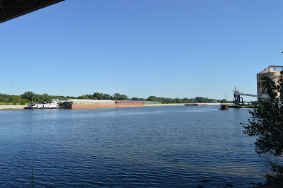 5:17:20 Note the parked tow has retracted its pilothouse. I realized that the little tow I had seen parked earlier when I was crossing the 9th Street Bridge was waiting its turn to go through the Lockport Lock. After the upbound tow had cleared the lock, the little downbound tow could leave for the lock. And this big 2x3 tow behind it had to park and wait for the little one to lock through. The good news is that the little tow will fit in the 600' lock without any disassembly. When the 2x3 tow reaches the lock, it will have to remove the pushboat from the barges and pull alongside them to fit into the lock.
 5:17:59 The upbound tow makes steady progress.
 5:19:10
 5:19:37 Clearly, a 2x3 tow.
 5:20:14
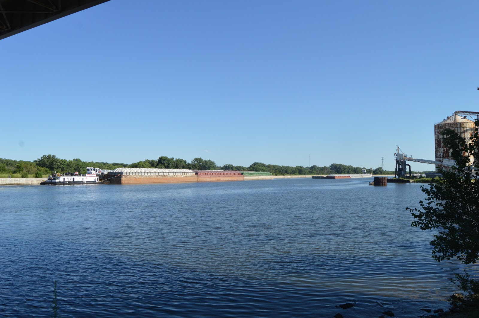
 5:20:21 There is enough action I don't want to read my magazine, so I took a photo of the abandoned grain loading facility while I was waiting for the upbound tow to pass.
 5:21:02
 5:21:26 Then I got excited when I could read the name of the pushboat: Sam M. Fleming for the Inland Marine Service. It is interesting that it does not carry an Ingram sign. So I got the answer to the question I was after, how big of a tow was it pushing up the canal --- 2x3.

 5:21:49
 5:22:11 I then switched to video.
(new window)
5:22:59 You can tell from the relatively small propwash that the Chicago Sanitary and Ship Canal normally has a slow current.

5:23:23 And the Al Weaver is still parked with its pilothouse retracted.


I stopped and went out on the 135th Street Bridge, which not only has a pedestrian/bike lane, it has a nearby trailhead parking lot. But the tow was too far south to wait for it. I went home and periodically checked its location using the Ingram site. The furthest upbound I caught it was in the Cal Sag close to Donegal Excavating.
I suspect it delivered barges to Ozinga because when I checked later it was downstream at the following location. The pilot house had to be retracted for every bridge going upbound starting with the BNSF/Santa Fe bridge in Lemont.
I noticed the "dot" was close to a lot of empty barges. Then I determined that this is Illinois Marine's Channahon fleeting area. When I checked again the next morning (20180710 7:00am), Sam was still here.
I checked its location periodically over the next several days, and Sam made a trip to the Peru area and then back to the Chicago area. Once it spent many hours (more than a day?) just upstream of the Brandon Lock.


5:22:59 You can tell from the relatively small propwash that the Chicago Sanitary and Ship Canal normally has a slow current.

5:23:23 And the Al Weaver is still parked with its pilothouse retracted.


I stopped and went out on the 135th Street Bridge, which not only has a pedestrian/bike lane, it has a nearby trailhead parking lot. But the tow was too far south to wait for it. I went home and periodically checked its location using the Ingram site. The furthest upbound I caught it was in the Cal Sag close to Donegal Excavating.
 |
| Satellite |
 |
| Satellite |
No comments:
Post a Comment