
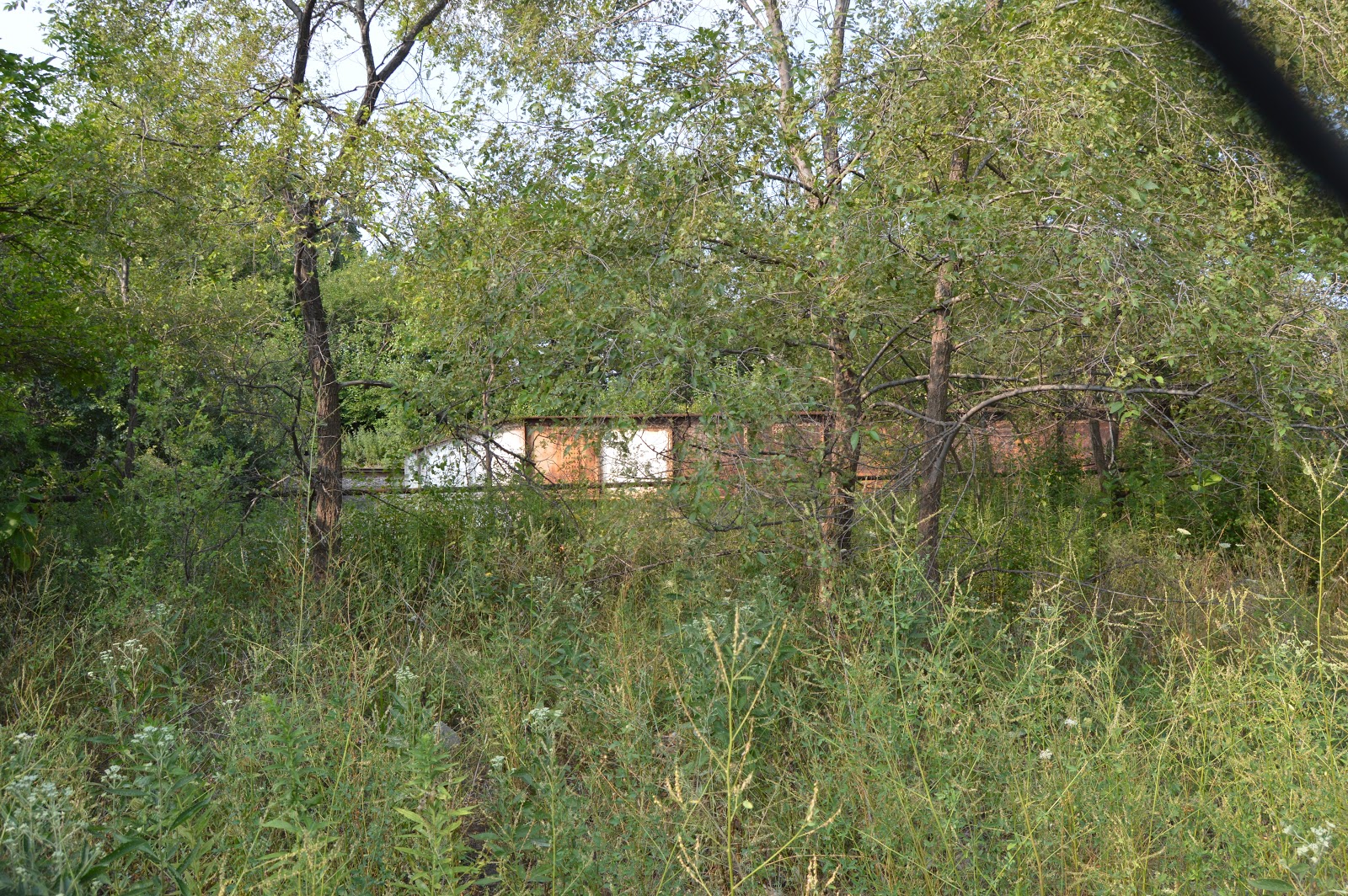
A couple views of the Best Foods plant.


The brick covered fire-prevention water tower is what is left of Hawthorne Works.

On my way back to the van, I got some views looking South.

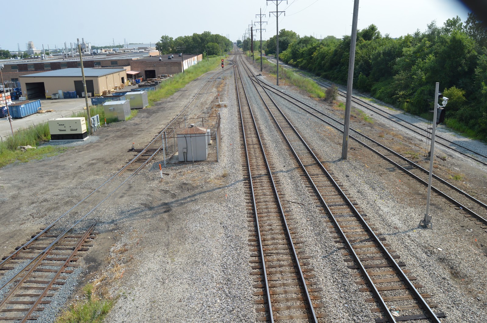

And some more views looking North.


I took advantage of the red light to record that I'm at Kedzie. I was driving East on 31st. Bing's street view still has the building that was on the corner on the right.

A note to myself to check out the smokestacks. They are for the powerhouse of the Cook County campus of buildings. Looking at satellite maps, I'm passing the collateral channel on the right. But the trees block the view of the rare Rall bridge of the abandoned Chicago & Illinois Western on the other end of that channel.

Now I'm going East on 26th Street. The Western Avenue Corridor crosses the road ahead. The embankment on the right held the Illinois Northern before it was abandoned.

There was an intermodal train on the overpass.
 |
| Zoomed in on the above photo |


Same crossing facing Eastish. On my right is a second set of tracks left in the road.

The second rail crossing south of Blue Island facing East. Note that the Kehoe Designs building used to be rail served. I think Kehoe Designs and its partner tenants of The Geraghty and Boomerang Exhibits uses big, tall open spaces for display rooms and events (e.g. weddings) rather than warehousing.

The second crossing is the track on the left. This photo focuses on the spur that used to go to the above building.

I've never seen a crossing marker this primitive in the big city.

The "main" track goes up the embankment to the bridge over 26th that I identified above for the BNSF branch.

Does the Frozen Assets building on the left have a single door that was for rail service or is this a new building that never had rail service?

I was amazed that the track that is still used is in such poor condition compared to the abandoned industrial spur.

The second crossing with its wooden crossing marker made me more sensitive to the crossing markers. This photo records that the first crossing has warning lights. The sign claims 2 tracks. But the closer one is only in the road. It has been torn up along the right-of-way.

This is a view of the former rail-served building from the north side. As mentioned before the building has been repurposed as Kehoe Designs on this side and The Geraghty (event space) and Boomerang Exhibits on the other side.

I guess I forgot that I already got this view. (First crossing looking Eastish) Maybe I'm recording that BNSF has installed a rather new crossing here.


I parked the van off Blue Island and I'm walking back to Western Avenue.

At the corner of 26th+Blue Island and Western Avenue looking West.

I crossed Western Avenue and I'm looking South.

Turning 90-degrees to my right, I'm looking West at the overpass for the curve in the CB&Q branch.


Having walked further south, I take a photo looking North at these relatively new overpasses. The one we see is now abandoned. I wonder if it is the newest abandoned overpass in Chicago.

The headhouse of the abandoned Santa Fe or Damen grain elevator is in the background.

Looking north at the Western Avenue Corridor from the west driveway of the Rauner Family YMCA.

Same view but I'm using the view screen so that I can hold the camera above the fence.

A couple of buses that they have parked in the northwest parking lot.

Looking south at the Western Avenue Corridor. It is obvious that a lot of the tracks that used to be in this corridor are gone or no longer used. NS/NYC/CJ would be the close double-track mainline and CSX/B&OCT is the further, and higher, double-track mainline.

Photo taken along the fence on the north side of the YMCA.

The BNSF/CB&Q tracks are on the bridge. The Santa Fe/IN tracks would have been in the weed patch in the foreground.

I'm trying to verify that the IN tracks have been removed. If they are still there, the weeds indicate they aren't used.

A better view of the bridge.
The east end of the bridge.

On the right is the south girder of the abandoned IN overpass.

An overview of the abandoned IN overpass.

Another view of the grain elevator.

When I returned to the crossing of 26th+Blue Island and Western Avenue on my way back to my van, I took this view looking North for complete documentation of the intersection. Actually, it was probably motivated by a fire-protection water tower that is still standing.

An example of intermodal trains increasing the truck traffic in an urban area.

I took this because the ambulance moved?

Noting a commuter train on the BNSF/CB&Q mainline when I was on 19th Street. (street view)

The west end of 19th Street. The first level is of track is a connector for the BNSF branch to the eastbound direction of the BNSF mainline. The second level is the flyover connector to the westbound direction of the BNSF mainline.

A couple more water towers that still exists.

I'm one block south along the east side of the corridor on Cullerton Street looking North. (street view)

I went to the far end of Cullerton Street and took a photo looking South. The bridge carries the CTA's Pink Line over the Western Avenue Corridor.

And then I turned to my right and took this photo looking North. That steel frame in the air is the agenda item for this part of the trip. It holds one end of the flyover for the connection to the CB&Q branch down to the canal area.

I turned a little to my right to include the smokestack.

I walked south on the access road and took this photo looking South. The building in the background is now used by the Cook County Government.

I turned to the right to get this view looking North.

I walked further North to get closeups of the frame holding the flyover bridge. The track on the left is a southwest quadrant connection to the BNSF mainline while the track on the right is a southeast quadrant connection. (This photo was shared on a Facebook post of the last train for Central Illinois.)


I moved the car a block south to 21st Street. Because of the vacant land, I was able to get a view of the frame under the Pink Line.

A closeup of that view. Note the water tower on the right. This is one that showed up in photos along 19th Street.

I moved to the end of Cullerton Street on the west side of the Western Avenue Corridor. This view is looking South.

Looking across the corridor we can see "the frame," the two water towers, and the smokestack. As a bonus, we can see the Willis/Sears Tower.

This track is a connector in the southwest quadrant that goes to the Western avenue Corridor rather than over it. This should look different today because of the Horseshoe Project.

Another view of "the frame" The bridge hangs from this frame because some tracks below did not let them place a pier here. This has got to be a great idea for model railroaders. And they can point to this example as a prototype for placing a bridge in a crowded area.

And another closeup

Looking East again

I'm back on 21st again on the east side of the corridor looking North. If they build on the vacant lot, this view will be gone.

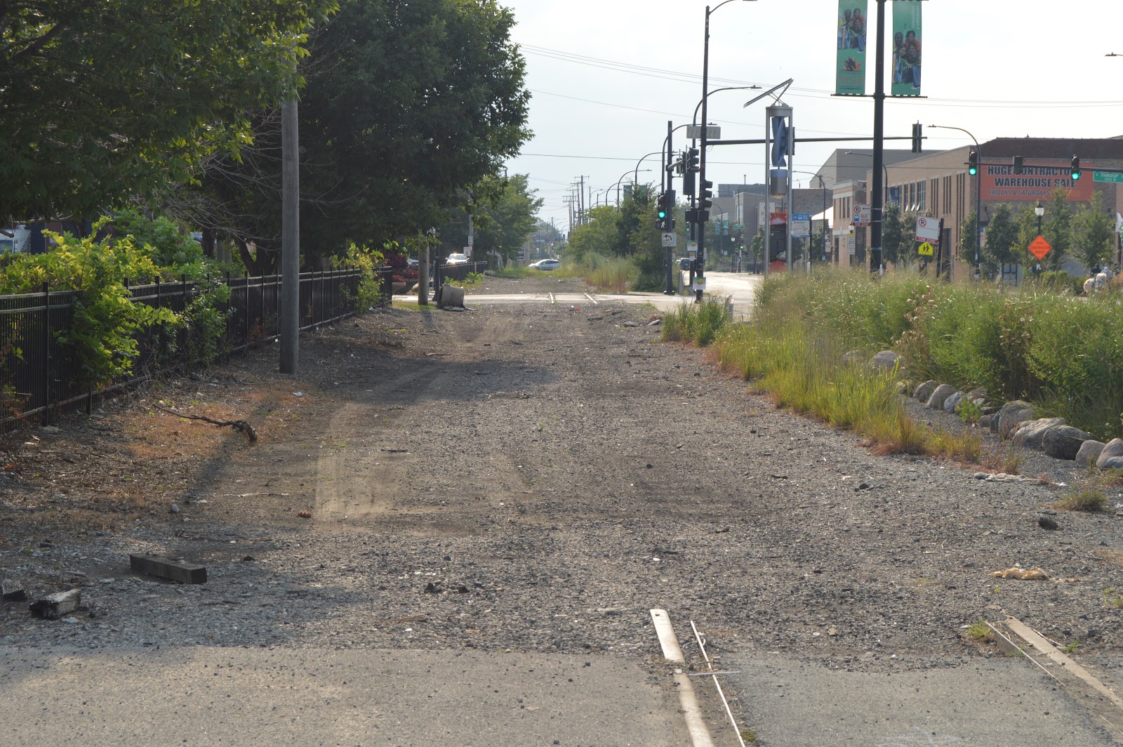
I was headed East on Cermak Avenue to get photos showing that the track along the south side of Cermak has been removed. That was another agenda item for this field trip. But I discovered that the street had been closed! The street sign is Allport.

So I pulled into the driveway to a parking lot at Allport. This view is looking East along the previous BNSF/CB&Q right-of-way. They were holding some sort of festival on Cermak. The track has been removed except for what was in the driveway.

Looking West. The track is gone except what was in the driveway and in Thorpe Street.
I was in the driveway of this building. Looking at Google Maps, there are several different businesses in this building. The signs are for Mana Contemporary. I looked at their web page, but I still don't know what they do.

A view looking south of east shows that the closed Fisk Generating Station is still standing. In fact, it appears that its smokestack is still intact. The substation is still used because ComEd built a high-voltage power line along the north bank of the Sanitary and Ship Canal to supply the electricity that used to be generated by Fisk.

Looking West along the abandoned BNSF/CB&Q right-of-way from Loomis Street.


A couple more water towers that still exists.

I'm one block south along the east side of the corridor on Cullerton Street looking North. (street view)

I went to the far end of Cullerton Street and took a photo looking South. The bridge carries the CTA's Pink Line over the Western Avenue Corridor.

And then I turned to my right and took this photo looking North. That steel frame in the air is the agenda item for this part of the trip. It holds one end of the flyover for the connection to the CB&Q branch down to the canal area.

I turned a little to my right to include the smokestack.

I walked south on the access road and took this photo looking South. The building in the background is now used by the Cook County Government.

I turned to the right to get this view looking North.

I walked further North to get closeups of the frame holding the flyover bridge. The track on the left is a southwest quadrant connection to the BNSF mainline while the track on the right is a southeast quadrant connection. (This photo was shared on a Facebook post of the last train for Central Illinois.)


I moved the car a block south to 21st Street. Because of the vacant land, I was able to get a view of the frame under the Pink Line.

A closeup of that view. Note the water tower on the right. This is one that showed up in photos along 19th Street.

I moved to the end of Cullerton Street on the west side of the Western Avenue Corridor. This view is looking South.

Looking across the corridor we can see "the frame," the two water towers, and the smokestack. As a bonus, we can see the Willis/Sears Tower.

This track is a connector in the southwest quadrant that goes to the Western avenue Corridor rather than over it. This should look different today because of the Horseshoe Project.

Another view of "the frame" The bridge hangs from this frame because some tracks below did not let them place a pier here. This has got to be a great idea for model railroaders. And they can point to this example as a prototype for placing a bridge in a crowded area.

And another closeup

Looking East again

I'm back on 21st again on the east side of the corridor looking North. If they build on the vacant lot, this view will be gone.

I was headed East on Cermak Avenue to get photos showing that the track along the south side of Cermak has been removed. That was another agenda item for this field trip. But I discovered that the street had been closed! The street sign is Allport.

So I pulled into the driveway to a parking lot at Allport. This view is looking East along the previous BNSF/CB&Q right-of-way. They were holding some sort of festival on Cermak. The track has been removed except for what was in the driveway.

Looking West. The track is gone except what was in the driveway and in Thorpe Street.
I was in the driveway of this building. Looking at Google Maps, there are several different businesses in this building. The signs are for Mana Contemporary. I looked at their web page, but I still don't know what they do.

A view looking south of east shows that the closed Fisk Generating Station is still standing. In fact, it appears that its smokestack is still intact. The substation is still used because ComEd built a high-voltage power line along the north bank of the Sanitary and Ship Canal to supply the electricity that used to be generated by Fisk.

Looking West along the abandoned BNSF/CB&Q right-of-way from Loomis Street.

Hey, Dennis, thanks a whole bunch for helping me solve a conundrum on my HO layout. The hanging bridge is brilliant. I saw a sketch of it in Mallery's 'Bridge & Trestle Handbook' and now you've given me the detail shots I need to build my own version.
ReplyDeleteCheers!
Philip Darkins
Wellington
New Zealand