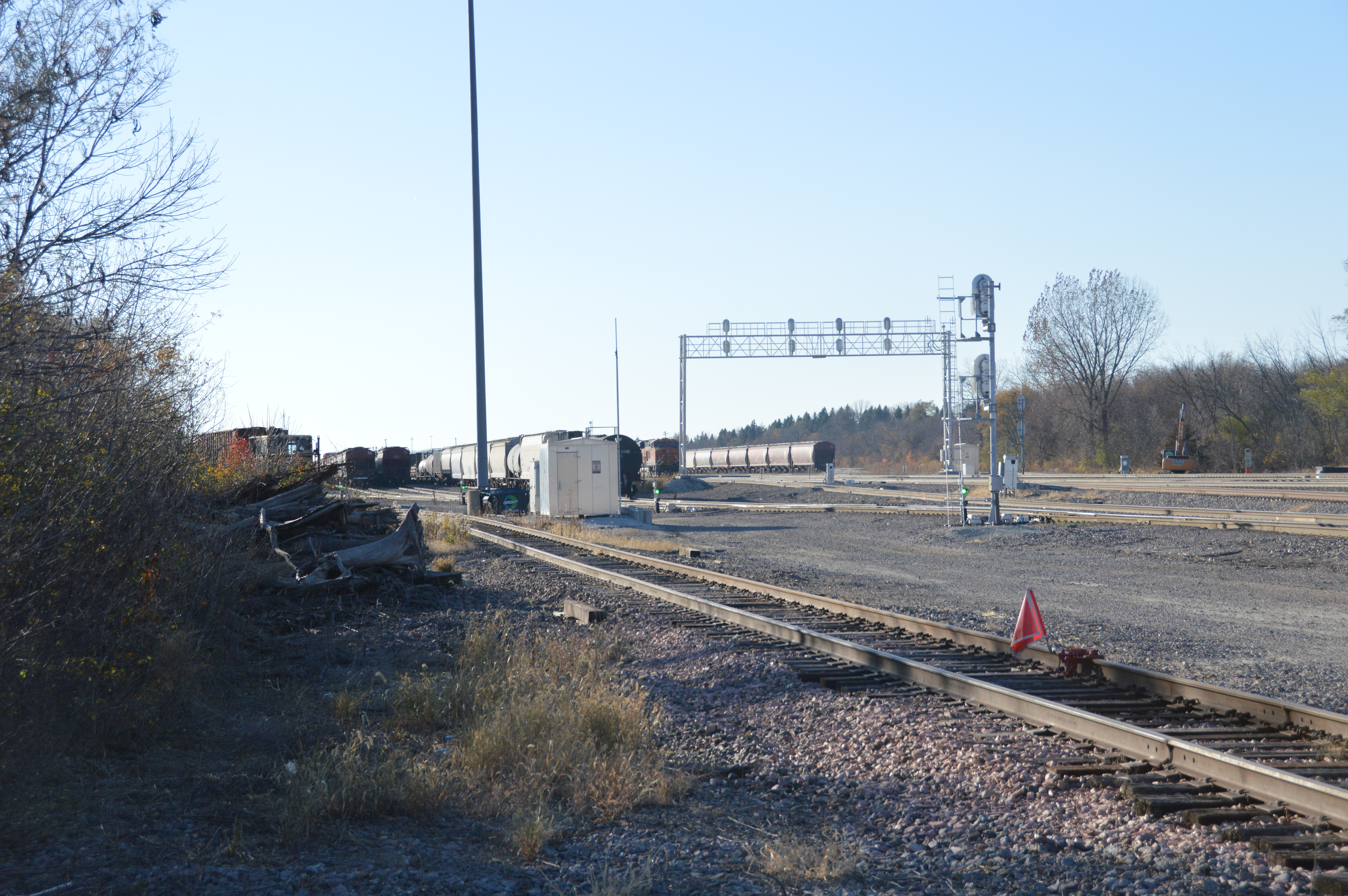


This shot is looking timecard east along the BNSF/CB&Q tracks. The purpose of this shot was to catch the foundation on the left. That is where the Montgomery Interlocking Tower stood. The road crossing the tracks is Webster Street.

I have crossed Webster Street and we get a better view of the Burlington Junction Railway locomotive, BJRY 1518, on the left and the rectangular grain elevator down by the little railyard. The big building with the conveyors going in the side must be the mixing plant for Ozinga Concrete.

I didn't walk around the hill to get a better view of the locomotive because I remember taking photos from the other side on another trip. But I have yet to look for them.

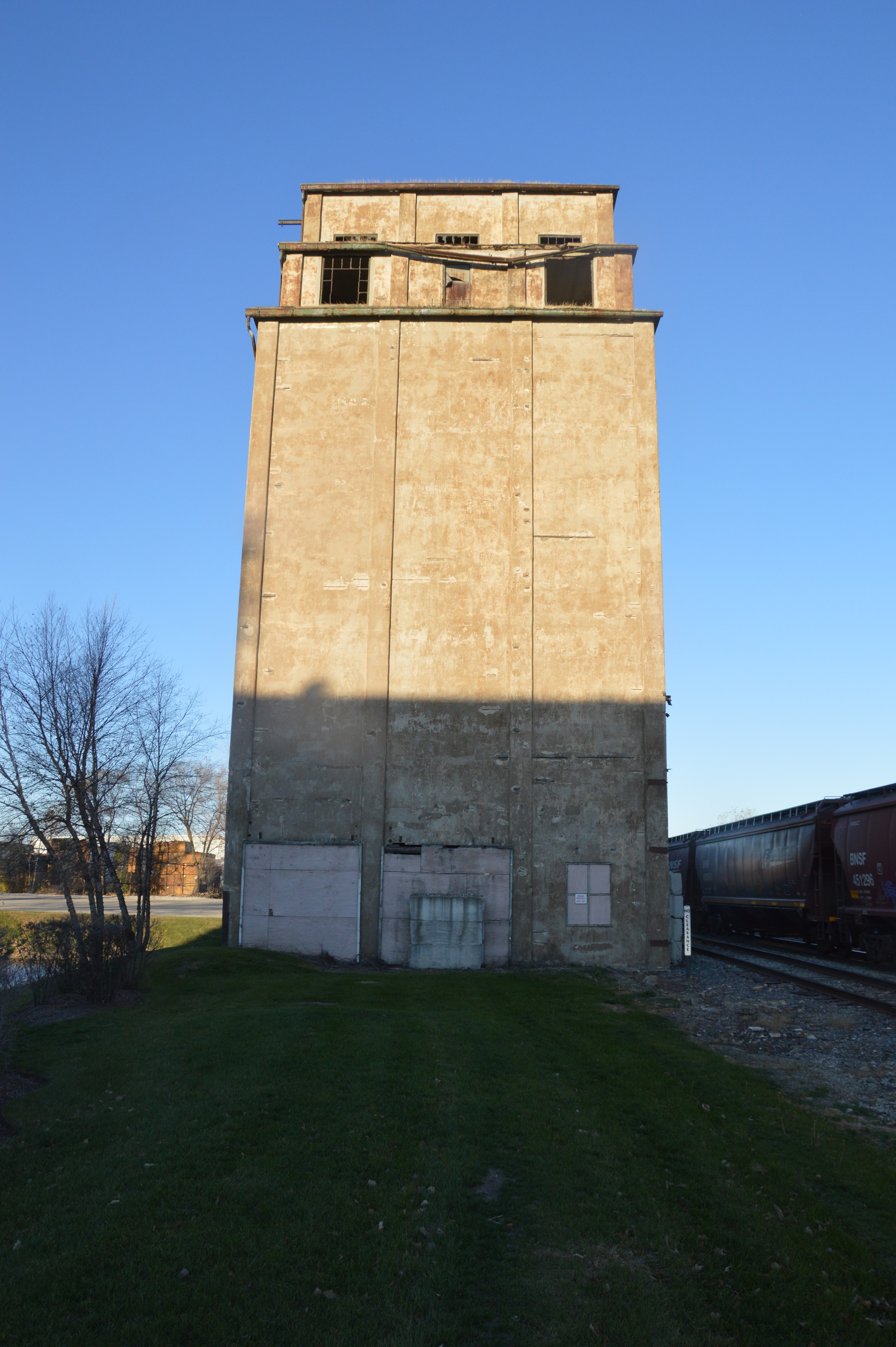
A test of the focus and resolution of the camera. I discovered below that my closeup of this side did not show the windows at the top very well.
 |
| At camera resolution |

 |
| Digitally Zoomed |
This grain elevator was one of the main objectives of this field trip. I went on a day that had some blue sky with a soft winter sun. But the sun was still powerful enough to create shadows from the big Ozinga mixing plant building.

 |
| Bottom part cropped out |
I also took a full-frame shot to have all of my options. The keystone effect is not too bad.

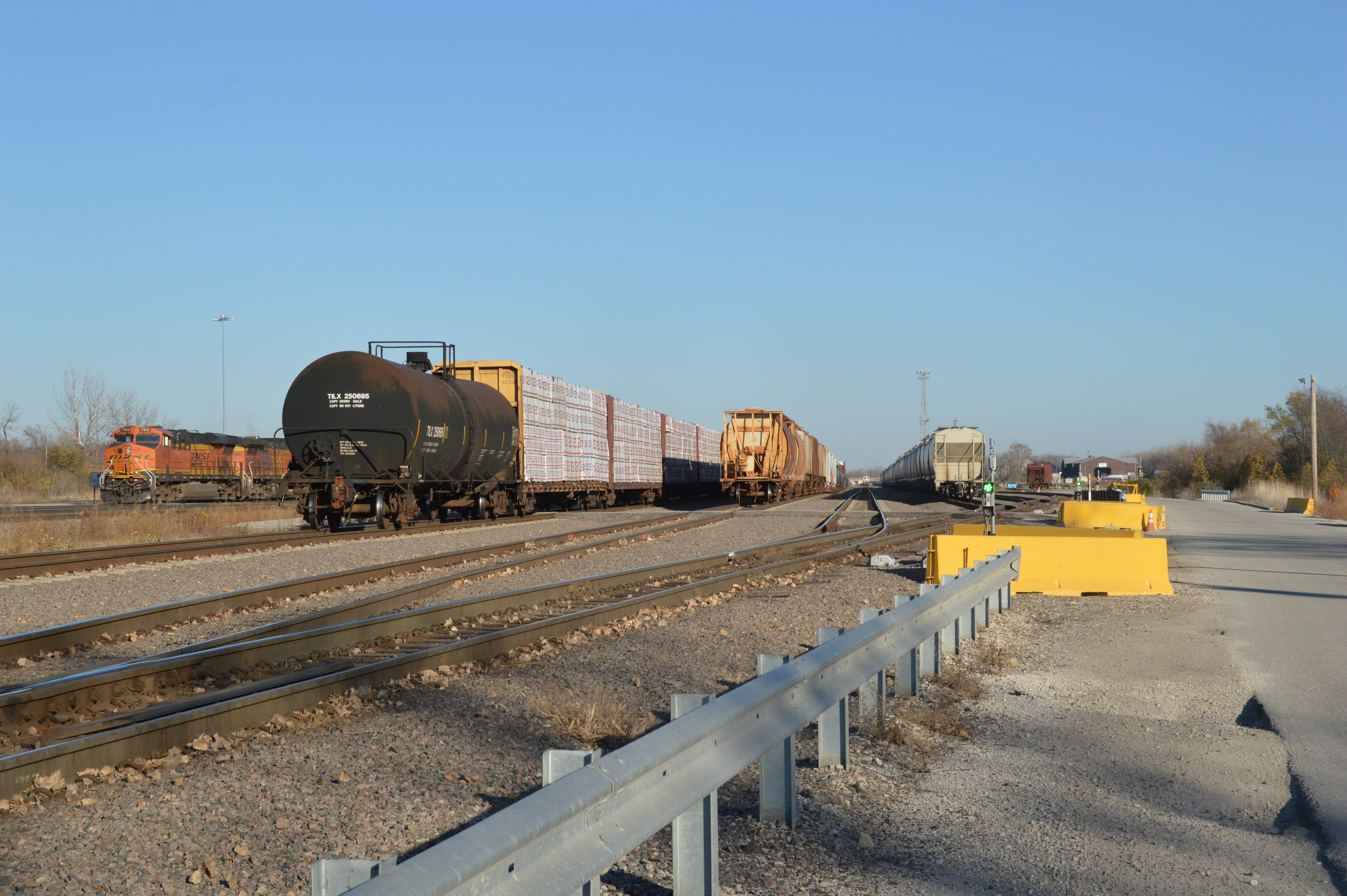
The same view, but I included more of the railyard that is behind the elevator. And it needs to be cropped.


Now I'm in Montgomery Park taking a shot of the dam, another item on my field trip agenda.


I then continued North on River Street to the parking lot of South River Street Park. This is a trailhead for the Fox River and Virgil Gilman Nature Trails. This plaque was where a connector to the Gilman Trail leaves the River Trail.

I was going to skip taking this shot because of my shadow. But it was the only overview shot I could find.

I'm glad I did take the photo, because now I see I can crop the shadow out. Although I'm debating how much to crop.


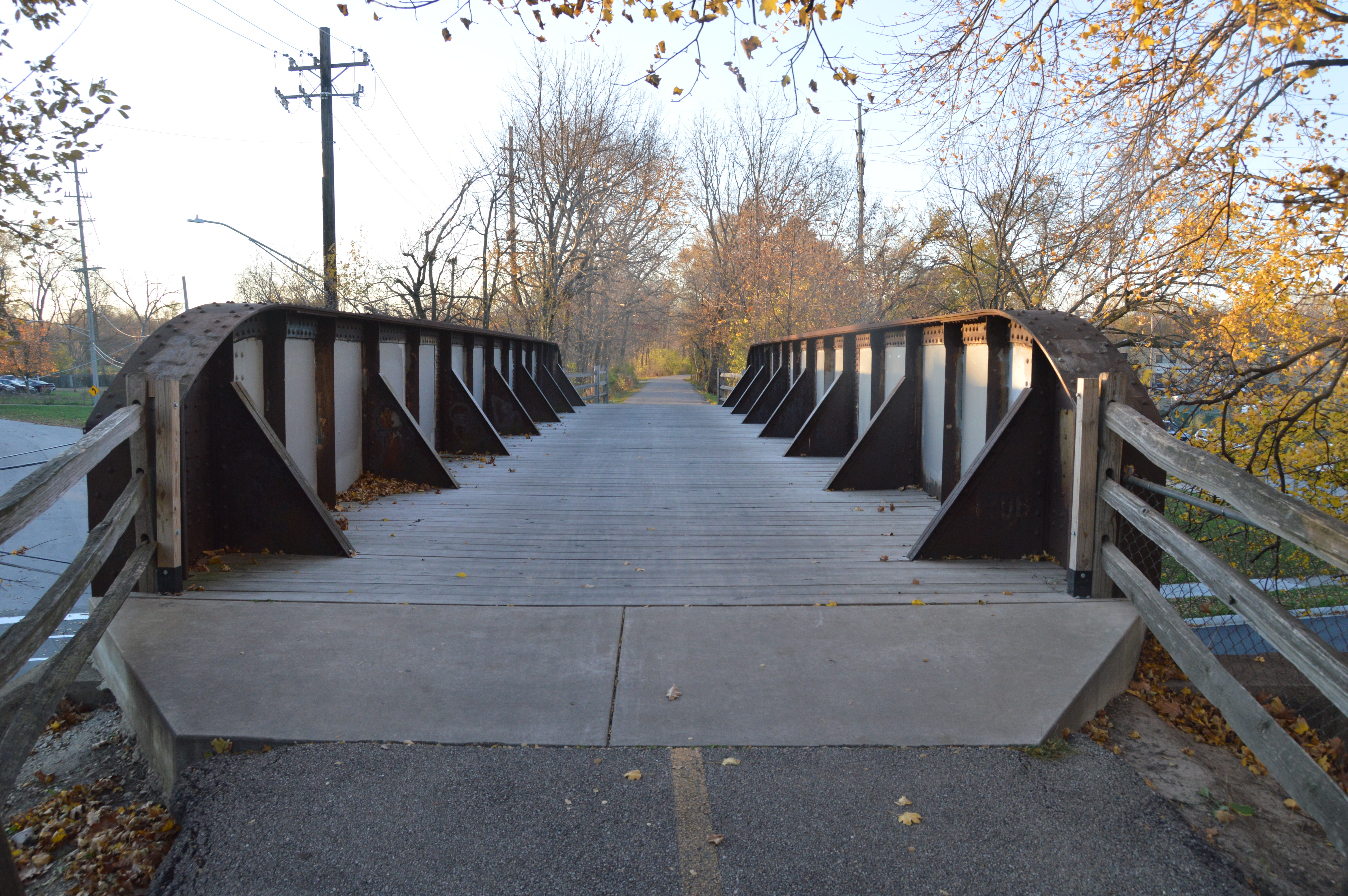
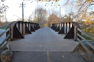
This bridge was another agenda item for my field trip because the two trails allow me to see the bottom and the top.

It was built by the EJ&E, and it was used my Milwaukee's CM&G.

As I do with all old truss bridges, I was analyzing whether or not the tension members get lighter near the middle of the bridge. I was shocked to find that one of the diagonals in the middle of the bridge was designed as a compression member instead of a tension member. All steel compression members can act as a tension member, but not vice versa. So I think they moved a short span from someplace else and added more panels to that span to make it longer. The above photo shows that both spans have the heavy diagonal in the middle of the truss.

Some shots of the underneath.


I'm trying to get the dark underside to dominate the frame so that it will be exposed better. Looks like I'm going to have to play with Gimp anyhow.

I am a sucker for cut stone piers.

I found a break in the tree line on the upstream side of the bridge.

This is the overpass bridge over River Street. I believe the diagonal plates are called "knees."
I had trouble parking because I had to squeeze in around a sheriff and police car in the parking lot. I see they are still having discussions with people.

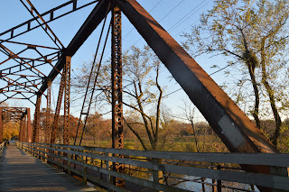
An obligatory portal view.

And a view of the truss.
I'm trying to get the structure that is below the deck. Note there was a walkway on this (downstream) side of the bridge.

Electrons are cheap. Finally, I was able to get a shot leaning over a rail that is vertical. In fact, I did it two photos in a row.

I walked along the bridge taking a photo of each stringer connection.


This is where the compression diagonal connects with the bottom. I knew that the bottom cords of a truss are in tension. These views have taught me that they get heavier as they get nearer to the middle. Specifically, the middle panel had four tension bars whereas the outside ones have just two.


What is the plural term for ducks? Gaggle? (Google says gaggle of geese or swans. But ducks are a raft, a team or a paddling. BTW, a gaggle of geese is three or more flocking on the ground. If they are in the air, it is a skein.)

A view looking upstream from the bridge. The Fox River tends to have islands in Aurora.

I walked west on the Gilman Trail to see if the underpass under the BNSF/CB&Q route offered a good railfanning view point. Because of the trees, no. Because the trail is straight here, we can see both underpasses. The close one is under the Mendota Subdivision that goes to Galesburg and Denver whereas the far one is under the Aurora Subdivision that goes to Minneapolis and the Northwest. [BNSF]

You can see the Aurora underpass a little better.

The sun sets early in November. I'm getting some golden light.


There was nobody behind me, so I took another view of the River Street overpass. Fortunately, I can rotate and crop the photo with Gimp.

The Mendota + Aurora overpass.

I parked near this corner to check out the Aurora Dam. I was glad to see they were rehabilitating this building.

My original goal was to take a photo of that tall building that I kept seeing in the background when I was down on the EJ&E bridge. Noting the location of the Paramount Theater was a bonus.

The east side of the Aurora Dam.