This blog helps me write http://industrialscenery.blogspot.com/. For example, it contains photo dumps of field trips with some text so that I can search the photos later. It is not intended to be read by others. But if you find photos organized by geography interesting, then enjoy.
I had to run an errand to New Lenox, so I checked out the depot that is going to be moved to make room for another CVS drug store. Then I went over to Joliet to catch the depot construction with the new platform. The new Metra+CN/GM&O/Alton depot in Romeoville allowed me to safely turn around on 135th to get pictures of a green locomotive parked near 135th.
20180326 0091
The Garmin routes me down Main+Lemont to I-55 rather than using I-355. So that allowed me to grab...
...some shots of the construction as I drove by. Obviously, they still have the tower crane.
I got caught at the traffic light so I had plenty of time to take some shots.
But the crane is pretty much done building the 5-story part. I have seen it hauling the bin that takes out the trash.
The time was just a little after two so I don't know why I didn't see anyone working.
There is an airplane above the trees behind the third house. I took this picture because that plane was rather low considering how far we are from O'Hare. At least they are not flying low to the west over our driveway anymore. That used to be rather noisy. (They also used to takeoff going above Main Street. That was so noisy that we could not here the TV when they were going by. But that hasn't happened in decades. I'm glad the flight patterns have changed.)
There is an ambulance and fire truck at the medical center by 68th. When talking with a fireman at a block party, I confirmed that whenever they send out an ambulance, they send out a fire truck. The reason is that all but four of our firemen are also trained as paramedic and having several paramedics gets the patient stabilized quicker. But I wonder what the paramedics can do that can't be done by the people in a doctors office. I hope things turn out OK for the patient.
As I was getting ready to take the ramp west from Lemont to I-55 South, I noticed there were trucks off on the side of I-55 east of Lemont.
That problem east of Lemont made the part of I-55 that I was using to the west clear sailing. But, as I expected, it made a bad gapper's block in the other direction. Taffic was slow on the other side as far as I could see --- all the way to IL-355. It always amazes and frustrates me how an accident on the other side of an interstate can gum up the traffic on the side that is not involved.
My errand in New Lenox was on the east side, so I had the joy of seeing the full US-30 strip-mall character of New Lenox between the I-80 exit and its east side. The mayor wants this depot removed because he wants a new one a little further east that has a tall clock tower. And he wants a CVS drug store here. A new clock tower is not going to had much class to the town. And the CVS store will definitely add to the ticky-tacky strip-mall flavor of the town. This is the view as you turn in from US-30.
A view of the east side after I looped around the parking lot. There was just one space open. Downers Grove posts that parking is free after 11am. But they talked about just the all-day fare here. I'm retired from working with computers. I don't have a smart phone. And I'm not going to bother to figure out how to do a pay kiosk for a few minutes.
On the platform looking eastish (inbound). You can see the truss carrying Metra's SouthWest Service track. (This was formerly a Wabash route, but it has been abandoned south of Manhattan, IL.) Note the crosswalk to the platform for the second track.
Turning 180-degrees. The depot is near the west end of the platform. There is another crosswalk at the depot and a third down by the Cedar Road crossing.
I went to the far platform to get this 3/4 shot of the depot. Note the green boards that filled in the big freight door that used to be on the end of the depot.
I turned to capture the view to the west from here. That is when I noticed the former grain elevator in the distance by the track. Note the tan brick building that is this side of the former grain elevator. I'll refer to it later.
I walked down to Cedar Road to get a 3/4 view of the other side and the full length of the platform.
A shot of the interior from the southeast corner. This would have been the freight side of the depot. I confirmed later that the green door on the left was a restroom. I learned in Cicero that you can't assume all Metra depots have a restroom. The book stand is in the bay window that use to house the agent's desk.
It occurred to me to take a view of what the agent would have seen looking out his side windows because these views will soon be lost forever. This is looking inbound.
The corresponding outbound view. Note the curved eave brackets. Big eaves and fancy brackets to hold them are as much a part of the depot architecture lore as the bay window for the agent's desk.
An overview from Cedar Road showing that the most important aspect of a suburban commuter depot is parking. A farmer is going to preserve the building by moving it to his farm. But I wanted to record the context of where it was built.
The east side of that former grain elevator. It looked like the previous user was no longer in business. Then I saw a for sale or rent sign.
The west side.
It was the yellow crane that caught my eye. But I see there is also a white crane further ahead in the intersection.
I'm on the safety island of Cedar Road looking west.
Same location looking east. I'm killing time waiting for the 3:30 inbound.
I'm getting really bored while I wait for the train.
Then it occurred to me to get a track side view of the grain elevator. I crossed the tracks and walked north along Cedar Road to get a trackside view of the grain elevator.
I found a better view.
A few more commuters are beginning to gather. Every once and a while, there was an automated announcement saying that inbound trains (to LaSalle) use Platform 1 and outbound trains (to Joliet) use Platform 2. But you have to look hard to find a sign that will tell you that Platform 1 is the one away from the depot. That is, you have to use the crosswalk to get to it.
Oh boy, the gates are going down.
15 seconds later, it was peaking around the curve.
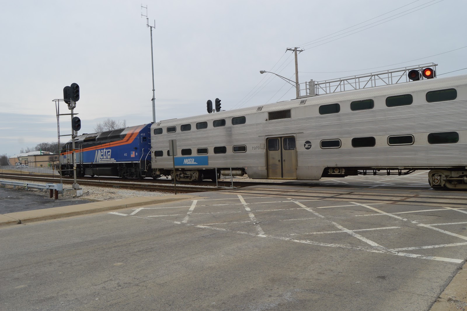
The curve allows you to see the cabcar, the engine, and several of the other cars. It is obvious that Metra is running "left-handed." I thought only UP/C&NW did that. And the reason was that they built their depots on the north side of the tracks. More on this later.
I'm not a normal railfan, so I just took a bunch of pictures as it came to town.
I think it is at rest at the station.
Platform 1 is not long enough to hold the whole train.
I believe that is the paint scheme for a rebuilt locomotive. Given that all of the rebuilds have happened recently, I'm surprised how much soot the engine is blowing out of the stack.
The exhaust was quite dirty.
It is not much more than a "dot" under the SWS (Wabash) bridge.
Newspapers are not completely obsolete.
A closeup of the filled in freight door. And those curved brackets holding up the big eaves.
I was trying to catch that there was a stairway spaced every car-length along the platform. And we see much more of the parking lot with this shot.
This is a better view of the stairways. I see there is a sign with a number near each stair. Near the end of my stay, I saw a sign that said inbound trains used Platform 1 instead of 2 after 2:00. After seeing these stairs, that explains why the trains switch to left-hand running after 2:00 --- the rush hour commuters can easily walk to the parking lot or the pickup drives. If they continued to run right-handed, the rush-hour crowds would be dumped on that little platform on the other side and then have to funnel their way across the tracks using just three small crosswalks. This is something the BNSF should consider for Downers Grove because now a huge crowd has to wait for the train to leave and then squeeze across the Main Street crossing. Not only is the parking garage and a lot of the condos and apartments on the south side of the tracks, the buses also park on the south side.
Then I took US-30 on into Joliet. I looked for the Lincoln Highway mural, but I may have turned south before I passed it. When I go to Joliet Union Depot, I turn south on Eastern Avenue so that I can get south of the Metra/Rock Island tracks and then go west to the parking areas. Eastern Avenue passes the high school,
and this time I noticed the castellations on top. To me, it makes it look like a prison. Actually, that is a rather appropriate metaphor for a school.
I've walked under the overpasses and the new depot is on my right. I'm looking south along Mayor Art Schultz Drive. On the left is one of the entrances to the RI Metra service, and we can see that a train must have recently arrived and unloaded some commuters. The Gateway Center sign is on a new pedestrian bridge that will connect the RI platform to the new depot.
Turning a little to my left, I get the entire RI platform. The "hut" on the ground is the RI ticket office until the new depot is done.
Turning towards the north, we can see a Heritage Corridor Metra train waiting for its departure time.
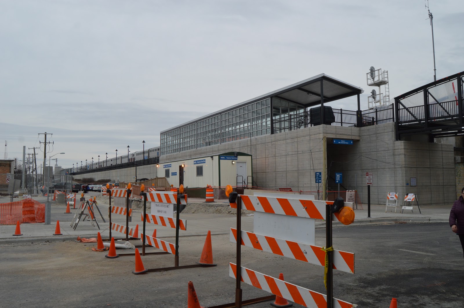
One reason I visited now is that they have the tunnel to the new platform open. This shot was taken from where the stairwell puts you on the platform.
From that spot, I turned to the right to get a platform level shot of the new depot and the junction tower. The tower is no longer used, but Bill Molony, the president of the Blackhawk Railway Historical Society, asked the city officials who wanted to tear the tower down to talk to their city engineers. The engineers confirmed it would be cheaper to leave it because it provides embankment walls. The current plans are to preserve it as a tourist attraction and offer tours.
And this is the view looking on the left (West) side of the stairwell entrance to the platform.
Another view to the East side to catch the Rock Island Metra train waiting for its departure.
One reason for taking this shot from the entrance to the tunnel to the new platform is to record that NO TRESSPASSING sign. The fine print reads: "TICKETED PASSENGERS ONLY." That is why the above four platform level photos were taken from the stairway entrance. I quick grabbed the shots and then left the platform.
This is another view from the tunnel entrance, but in the opposite direction looking into the depot. You can see the steel door on the far right that is currently closed. You are not yet allowed to go into the depot itself because it is still under construction.
But it is close to getting done. This is a view through the glass from the tunnel entrance.
This image records that they have blocked off the stairway and ramp to the temporary platform now that the permanent platform is done.
From the above view point near Jefferson Street, I did a sequence of photos in a semicircle. Looking West.
Looking a little west of South.
Looking South.
Looking East. I believe this contractor's yard will accommodate auto traffic (e.g. kiss-and-ride) for the station when the construction is completed.
I picked a different vantage point for another circle sequence. This was on the east side of Mayor Art Schultz Drive as close to Jefferson as I could get without trespassing on the contractor's yard. Looking Northwest. When construction is done, I presume Schultz Drive will be open and this scene will be full of traffic.
Looking Southwest. This is basically taken from as far away as I could get without trespassing on the contractor's yard. The archway on the northeast side, the one closest to me, is the one I went through to get into the platform tunnel's entrance vestibule.
As I walked back to my van, I took another photo from the east side of Shultz drive looking Northwest.
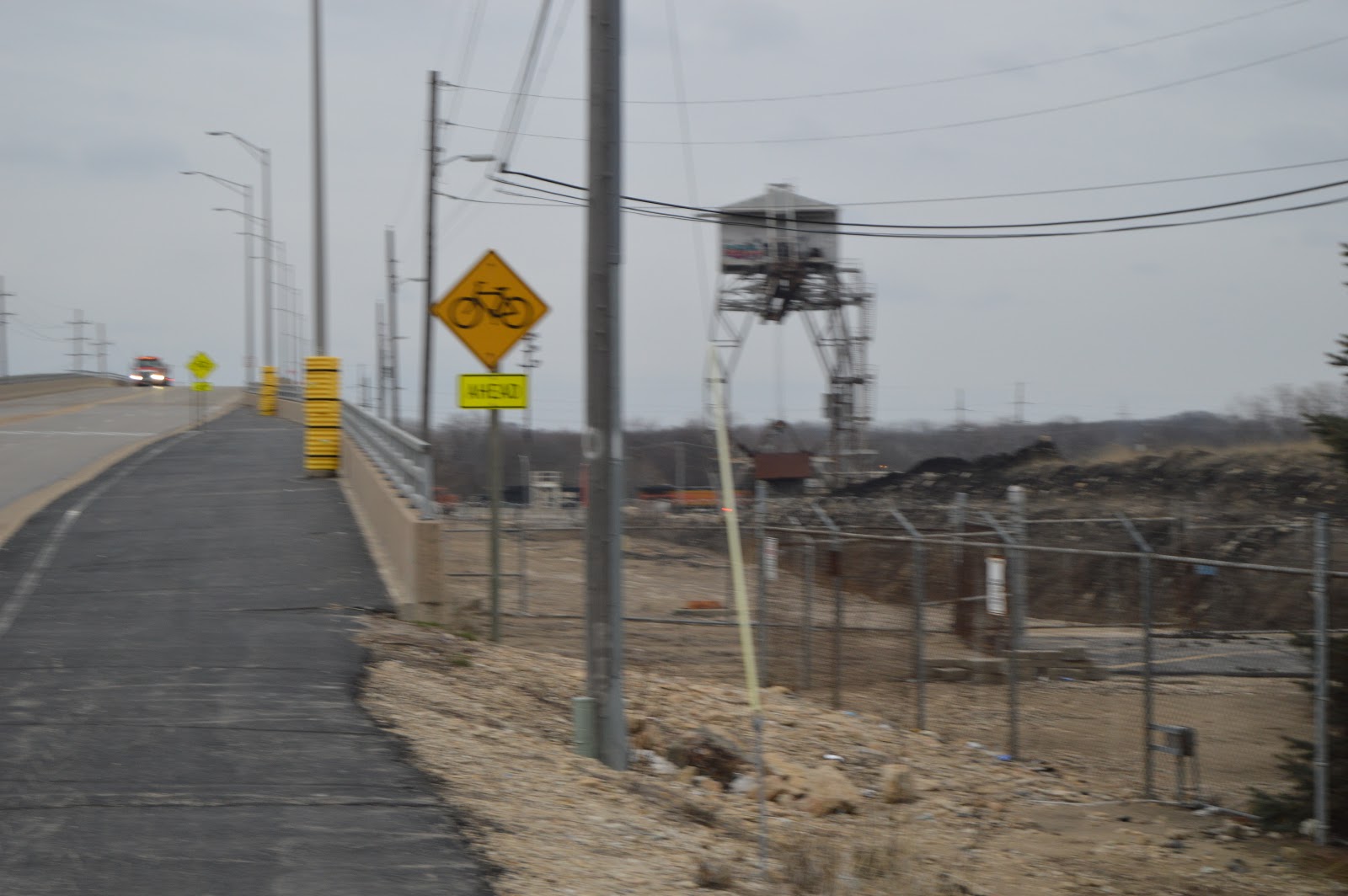
Not only did they build a new pedestrian overpass, they completely rebuilt the overpass that carries the one track that is left. (Rock Island used to have several tracks across this road.)
And this is why they rebuilt the overpass. This is the first time I have seen holes in support girders because the rust has been allowed to completely eat through the steel. The reason it has been allowed to rust away is because this overpass no longer carries any tracks. I assume they are going to eventually remove this overpass. If they let all of the paint wear off, then they won't have to worry about dealing with lead paint when they do the demolition.
The new overpass on the right, the old (and unused) overpass on the left, and the door to the tunnel that lets you get to the other side of the original Union Depot.
From that same vantage point, I turned to my right so that you can get a better feel for how the elements of the new station fit together.
At the end is the door we saw above that allows entrance to this tunnel. I'm standing where this new part ends and we join the hallways of the old UD.
As I went up the stairs to the platform on the former depot I heard a train, and when I got to the top of the stairs I saw a westbound (geographically northbound) intermodal train was coming.
So I got closer to the standard railfan spot at the corner of the platform. Yes, there is no sun. I don't take photos to sell, I take them to record the frequency and type of trains that are running. But I have to admit, the blandness of the photo makes you appreciate why a real railfan won't even go outside unless it is sunny. (I noticed the New Lenox depot exterior pictures were also rather dreary.)
Then I hustled over to the UD wall to get room for the closer shots.
BSNF #6709 ES44C4 3-9/11
BNSF #8258 ES44C4 1-11/14 So evidently a locomotive with a lot of vertical grills on one end is not necessarily a Tier 4 GE.
They just kept rolling by. And banging the diamonds. I've already made recordings of the sound of the diamonds being pounded, so I didn't make another one. Plus I don't think any laptop can recreate the loudness of the wheels falling into the gaps.
And kept rolling.
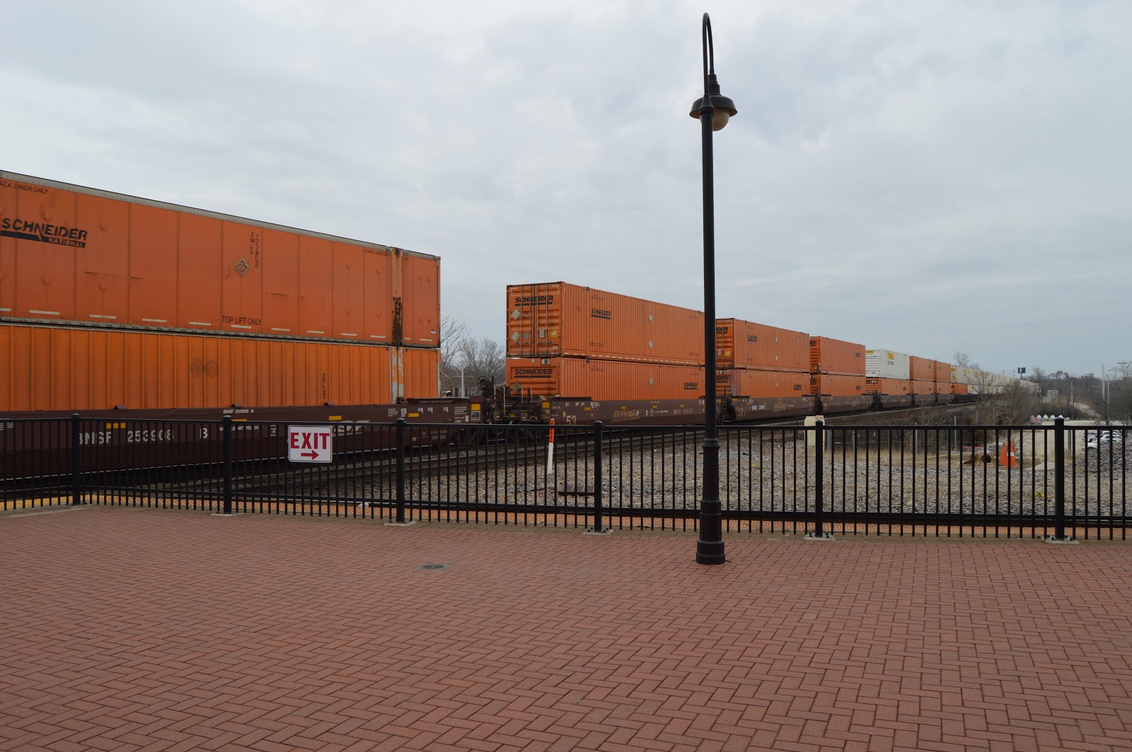
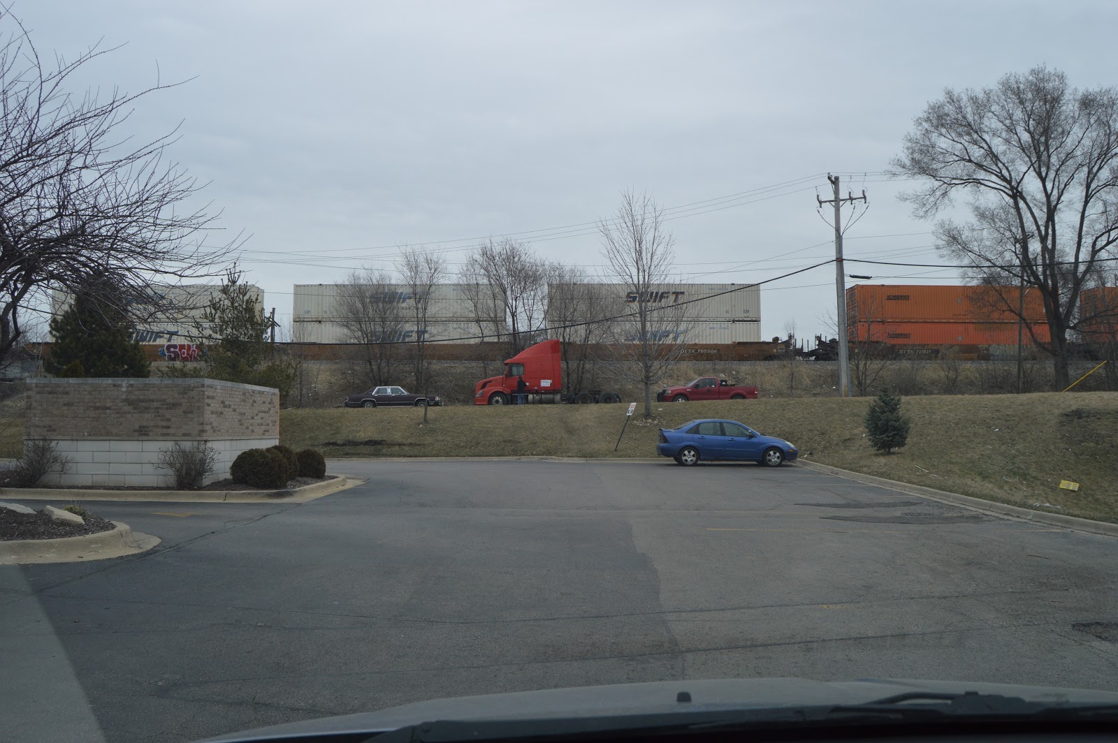
Hunt containers for as far as the eye could see. This was a long train. I by no means took photos of all of the cars.
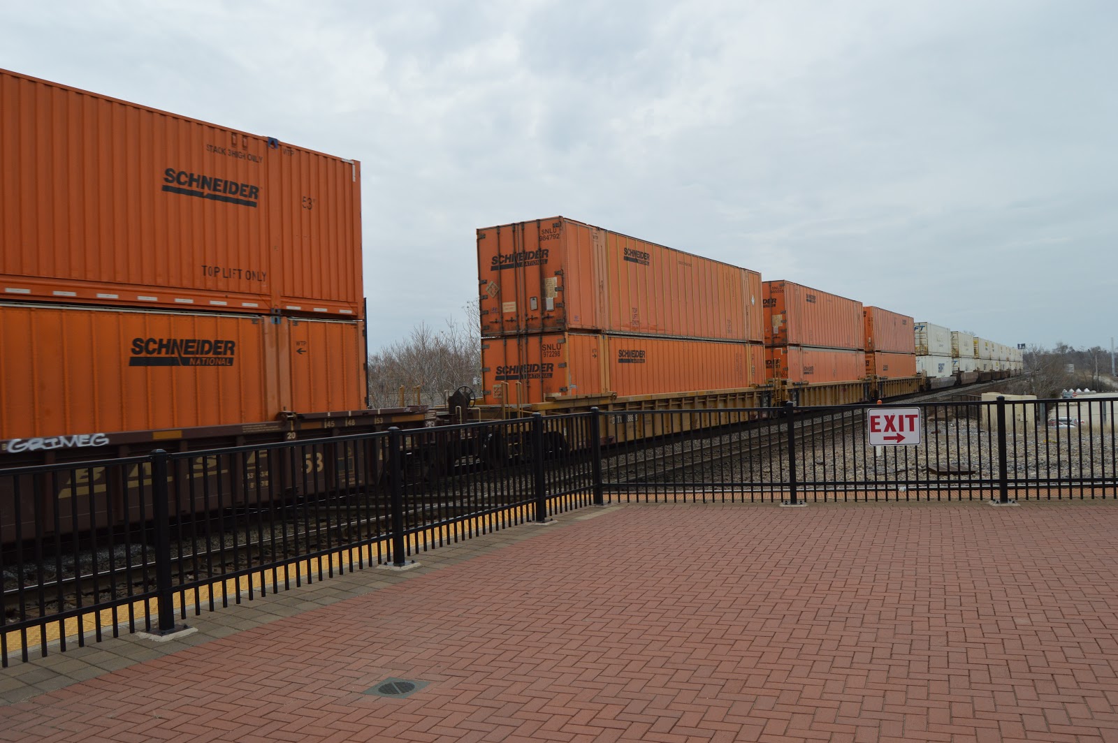
Finally, a little variety. "CMC TANK" The reporting mark is SNEU. It was an international 40' container because it did not fill up the 53' domestic well.
I'm getting bored with Hunt.
Finally, a little more orange.
Near the end.
So not all white containers are Hunt. I see at least a couple of SWIFT containers.
It wasn't deliberate, but I did a better job of getting the articulated bridge in this frame.
An overview with the tail of the train. The lamp posts are not vertical. Fortunately, I normally don't make that mistake.
When I realized my "going away" shot was an overview, I turned to my right to get the rest of the scene.
I went over to check out how the diamonds they installed a couple of years are doing. I quickly noticed that one bolt had fallen out.
So I systematically looked at all of the bolt locations. I found another empty hole. I put a red rectangle around the head of the broken bolt.
I'm practicing leaning over a fence to take a profile shot. I discovered at the Starved Rock Lock that I don't get this abnormal shot framed vertically. I have botched this shot of the diamonds in the past. I see that I'm still botching it. All the more reason I need to practice this shot.
This is the view looking west along the former Rock Island platform.
And the corresponding view looking east. The track that used the now rusted overpass was already gone when I first visited this site in 2015.
A shot of the new depot, the tower, and the Rock Island line.
I held the camera up to the glass of the door to the old waiting room and you can see what is now a ballroom.
The new platform is significantly longer than the temporary platform so I assume they will no longer have to seesaw the Texas Eagle to load the passengers.
I zoomed in on the temporary platform. You can see where the openings were for the concrete pads because they have put orange barrier fencing across those openings.
I went around to the north side of the old UD. I took this picture straight West to catch the crane activity.
They have closed the stairwell to the platform on this side. I wonder why. This makes me glad that I had taken the tunnel to the south stairwell. This shot also shows that they have put another one of those arched "Gateway Center" signs across the Jefferson Street overpass.
Turning to the right, I get another overview shot.
Which reminds me to get a close up of the relatively new articulated signal bridge. Note how the base of the bridge takes advantage of the gap between the tracks to make room for the new platform.
I'm back on the south side of UD. Another interior shot. This time from the other entrance to the former waiting room.
I took this picture to capture the grain leg just to the left of the brick building. Note the top of the lift bridge on the right side of that building. To the left of the leg, just to the right of the parking lot light, is the smokestacks of a power plant.
The downstairs is now a restaurant. But I was there on a Monday.
The two intermodal yards south of Joliet dump a lot of trucks on the roads around Joliet. I saw this container when I turned around after taking a shot of the menu.
They finally got the road under the BNSF+UP rebuilt as a pedestrian crossway.
I bought a Philly cheese steak sandwich at Shark Fish and Chicken. As I took the parking lot to go East on 4th Avenue, there was a southbound intermodal going buy.
I was headed south to eat my sandwich at Brandon Lock. I was in the wrong lane to take Zurich Road over to Brandon Road, so I took Laraway Road over. I could not resist getting this shot of the old, a corn crib, and the new, Dollar Tree Distribution Center.
There was no action at the lock. But I always try to stop by the bridge to get a shot of the flow over the dam and of the islands in the river so that I can compare river levels from one visit to another.
A grab shot after I turned around at the end of the bridge to head back to US-6.
I was headed to the US-6 drawbridge to confirm the grain leg I saw from Union Depot was for this Prairie Creek Grain transloading facility.
I walked across the bridge to confirm there was not much activity today. Just several trailers parked by their tracks.
The cement operations are processing some barges.
As I was driving north through town on US-6, I noticed a mixed freight was going over Jefferson, so I pulled into the unloading drive for the ballroom. This shot is a part of a tank car and some hoppers. (If it was an intermodal, I would not have bothered to find this parking spot.)
Another tank car in the mix of hoppers. That sign they added makes it hard to count the number of bins in the hoppers.
And now a good sized block of tankers. I got what I considered a good enough sample of the mix of cars so I started to pull away.
Then I saw the end of the train had a Santa Fe caboose with red and white paint!!!! So I tried grabbing a shot of it, but ended up with one of the worse shots I ever took. Railfanning is like fishing, the good ones get away.
I did some right hand turns to head south to try to catch that caboose. I parked at Eastern and 4th Avenues. I was amazed by how bad the BNSF overpass over 4th Avenue was. They have literally shoved some timbers up under it to help hold it up!
I waited a while before I decided that the train had beaten me to this overpass. It was getting late, and it had started to drizzle. (Rain was predicted.) I will note that the caboose went through Joliet at 5:45 in case it follows a daily schedule.
I took this picture to document that federal funds for high speed rail has built a new overpass for the UP.
While BNSF still has its timber patched rust bucket.
Another shot of the new overpass the feds have built for UP. Notice that the new overpass is not as wide as the old one was.
While waiting for the red light, I grabbed another view of the "prison" (high school).
As I approached Ruby Street Bridge, I saw a headlight on the BNSF tracks. So I hung a right after crossing the bridge because I knew there was parking along the river and a good view of the track. The first two engines were noticeably shorter than the third. I was so excited to see the short ones that I did not hold the camera study. The shutter speed was 1/125, so I should be able to easily read the numbers. But they are blurry.
BNSF #2748, originally a GP30 built in 7/62 as CB&Q 965, it has been rebuilt as a GP39-2/3
BNSF #2892, originally a GP35 built in 3/65, it has been rebuilt as a GP39-2/3
BNSF #538, Santa Fe B40-8W built in 10-11/90
Since I missed the caboose at the end of the previous train, I was going to stick around for the end of this one even though I'm sure they have only one local a day.
With mixed freights, I like to take some sample photos to record the mix of cars. Around here it is generally tankers and hoppers.
It is a long train. These photos are not a complete sampling. Sometimes I make an effort to take pictures of each segment of a mixed freight. But I'm too far away to read placards, etc.
I did another video to record that it is still going slow. The content is not worth uploading, just mostly more hoppers and tankers. No caboose as I suspected.
On the way home, I stopped in the parking lot by Rich & Creamy. When I got out of the van, I heard diesels. There are intermodal containers peaking through those trees. I took this picture just to record yet another westbound (geographically south) train passing by.
This parking lot is a trailhead for the Route 66 trail along the river bluff. I noticed after I left that there is an overlook on that trail just a little to the north from here. So the next time I hear a diesel, I'll try trotting (I don't run anymore) to that overlook.
I had been driving along the EJ&E Bug Line. I noticed that only one car was stored on it. And quite a bit of the wildlife area was black. So they had been doing controlled burns to help restore native prairie plants. I grabbed this shot to try to catch the lone stored freight car and the black area of another burn on the left. I did catch part of the stored hopper on the right. The church steeple with a clock in the background would be in Lockport, IL. The blurred trees are clutter in the foreground. The autofocus of the camera did pretty good this time. Sometimes if has a hard time getting a lock when the image keeps rapidly changing.
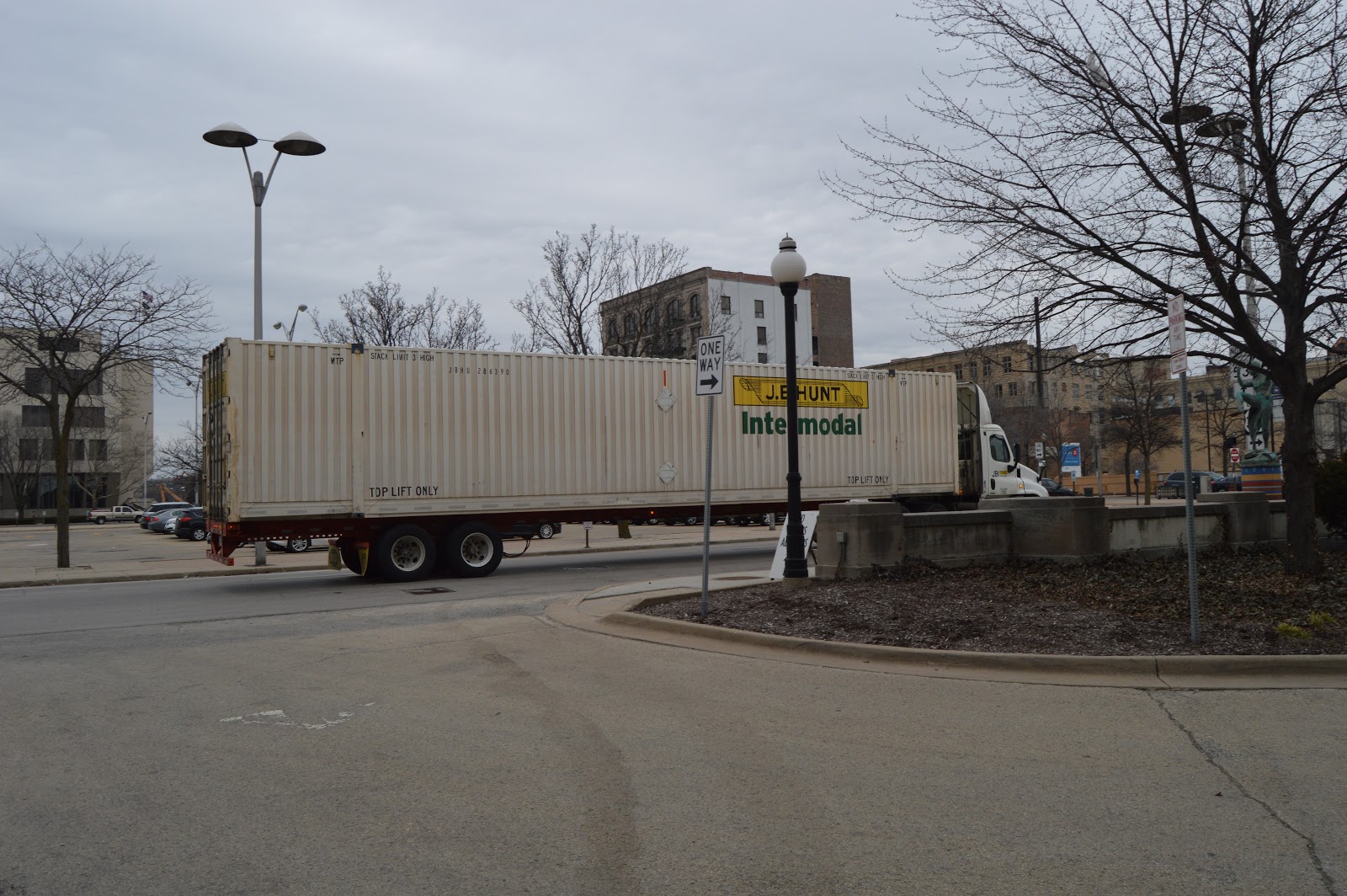
As I was using 135th Street to get from IL-53 to New Avenue to go to Lemont, I passed a green locomotive. (I avoid taking IL-7 into Lockport because that bridge can have really impressive traffic jams. And 135th is more scenic from both an industrial and nature point of view.) I didn't have the guts to turn left into a trailhead parking lot because I would tie up the left lane on a busy, fast-moving road. So I went over the bridge to find a place to turn around. That was serendipity because that reminded me that they have finished the new Romeoville Depot along the Metra+CN/GM&O route and the entrance has a new traffic light.
On my way back to the depot, I noticed these three cranes.
A view of the depot from the platform close to the parking lot. Note that the parking lot is on the outbound rush hour side when running in normal right-hand mode.
Standing at one end to get an interior shot. It has no bathroom or ticket agent. Just a kiosk to pay for parking. It makes sense there is no ticket agent because this Metra line runs only during the rush hours. And those riders tend to buy a monthly pass.
From the entrance to the depot, this a view looking back towards the parking lot.
Since the cranes were parked fairly close to the depot's parking lot, I walked over to the edge of the lot to get a different view. The "cart" in front is a boom dolly.
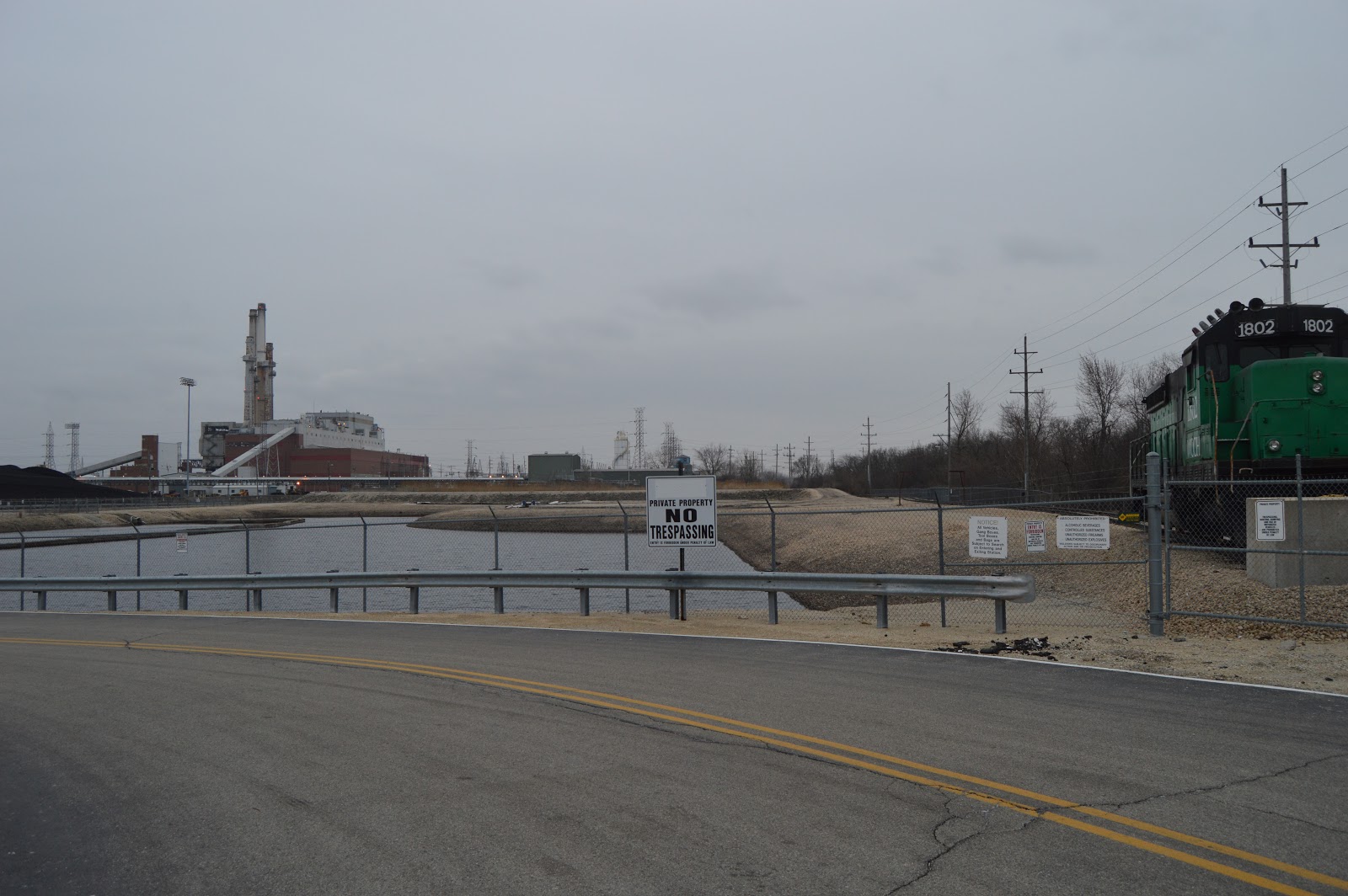
I have parked at the trailhead lot and crossed 135th to the south side. I took this photo to record that the coal storage lot is full. This is a puzzle because I have seen multiple reports that the small units have been shut down and the big units have been converted to natural gas. (I learned from a Facebook comment that this plant is still burning coal.)
I took this photo to record that a lead unit of another westbound BNSF unit is passing by on the other side of the canal.
I took several photos, because that train had several locomotives on it. Unfortunately, the camera's resolution doesn't bale me out this time and there are too many obstructions, so I can't determine for sure if it was four or five locomotives.
This is the reason I turned around and parked in the trailhead. This locomotive is parked on the northwest corner of the power plant's property. This shot is to get it in the context of the power plant.
I'm taking all of these shots through a chain link fence so that I'm not tresspassing. But that means I can't get the serial number off the frame so that I can research what type of locomotive it is.
An overview shot looking through their entrance.
I noted on my trip back across the bridge that a barge seemed to be docked by this plant. So on the way back, I grabbed some photos.
I zoomed in on this one. The barges are by the Prairie Material Yard 134. There are at least a half-dozen docked there. There is nothing by the power plant. Note also that there is a towboat heading south in the canal.
While driving on New Avenue to Lemont, I met the Metra train that will be stopping next at the Romeoville Depot.
While going over the High Bridge in Lemont, I noticed another westbound BSNF train was coming.
Four locomotives pulling an intermodal train.
It is going over the first bridge I photographed in the Chicago area when I came here in 1973. It is still a sentimental favorite because it is big, busy, and you can watch canal action as well.
I parked the van and walked back onto the bridge, but the train was gone before I could get a shot of it on the Des Plaines River Bridge.
When I drove across the bridge, I thought the river was really high because I could see the water was at the edge of its bank. But when I was standing still, I see it is in an inner bank. I now think this is the lowest I have ever seen it. I believe the bare bank has been covered by water in all of my other photos of this scene.
I took this photo to catch that the left abutment of the bridge is a few girder spans to the left of the current channel.