This blog helps me write http://industrialscenery.blogspot.com/. For example, it contains photo dumps of field trips with some text so that I can search the photos later. It is not intended to be read by others. But if you find photos organized by geography interesting, then enjoy.
BNSF changed their schedule, and the late afternoon inbound express now takes off from Main instead of Belmont so I caught it so I would have some time before my 7:30pm meeting to take some photos of the track work south of Union Station and some shots from Roosevelt Road.
By the way, we passed five outbound express commuters between Downers Grove and the curve to the north. Two trains passing each other at express speeds on adjacent tracks makes a noticeable noise. We went in on M3 (south) track. So we probably almost caught up with an inbound local. Five outbound expresses on M2, local outbounds on M1 and local plus express inbounds on M3 is why BNSF does not run freight trains between 4pm and 7pm. And why the Amtrak trains are scheduled to get out of the area before 4pm. I once saw them hold an inbound Amtrak train west of Forest during the evening rush. The penalty for late commuter trains must be worse than late Amtrak trains. I don't know if there are monetary penalties, but there are PR penalties. Also, if a BNSF inbound is late, that means subsequent outbounds that use that equipment will be late.
I hadn't planned on taking photos from the commuter car because I had done that on a couple of previous trips. (Got off at Halsted Stop is the only one I have posted. (FMI: 20161021)) But when I was able to see the top of the load of this run-through with NS and verify it was coal instead of petcoke, I quickly got my camera out of its case. At commuter speeds, it was a race, but I did get it out in time to catch a car and the two locomotives.
BNSF #9436 SD70ACe, built 2006
BNSF #5996 ES44AC, built 2006
Still BNSF #5996
There are a couple of tank cars parked next to the one story building. I took a picture to remind me to look for a rail-served industry.
As we go around the corner, there is some track supplies stored in the foreground and some Amtrak locomotives, a converted cold storage building, and the Canal RR Bridge in the background..
Thanks to the economics of digital photography, we can afford to take photos that turn out to be unusable.
Basically a shot because electrons are so cheap. It does catch the Amtrak yard tower.
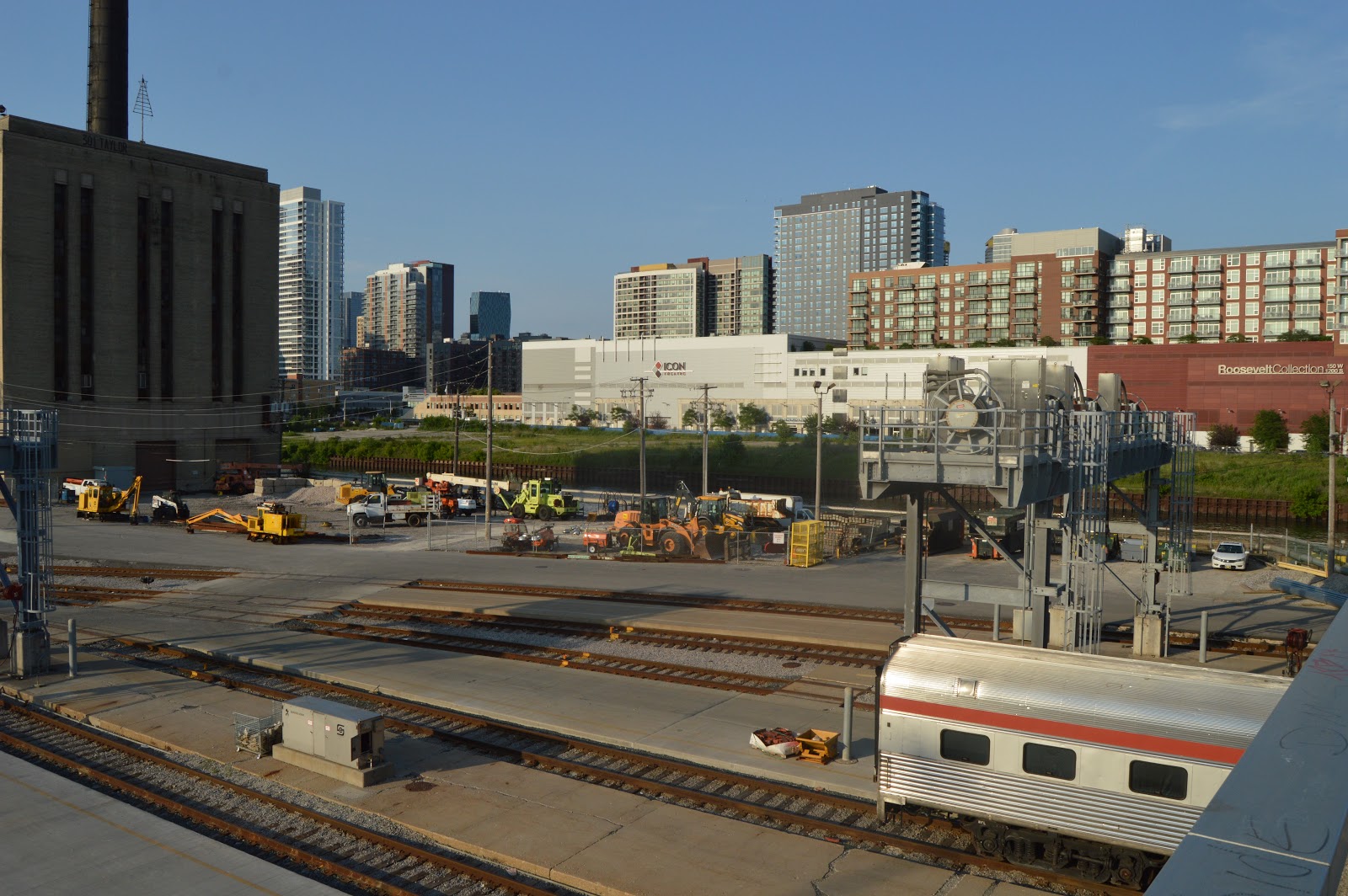
The Amtrak coach yard. But my main motivation is catching the skyline because the two tower cranes indicate it is going to change.
It is a good thing electrons (and magnetic fields) are cheap.
There is an "Amtrak truck" in this shot. I wonder if it is used to service the toilets in the passenger cars.
Camera Resolution
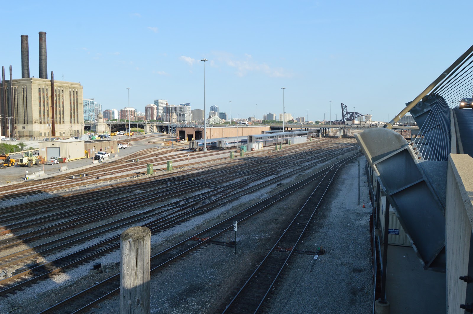
The smokestacks of the Union Station Power Plant and the long building that Amtrak uses to service trains.
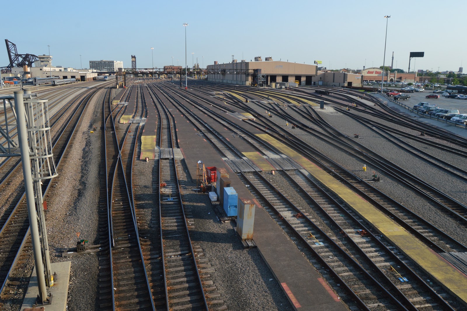
I'm beginning to get into some interesting track work.
More track work and skyline. Goldberg's River City is in the middle of the background.
Taking photos early and often.
They will replace those signals when they install PTC (Positive Train Control).
The ComEd switchyard is where the Pennsy Freight House used to be. River City was supposed to go further north, but it ran out of money.
We came to a complete dead stop under the New Post Office. I was noting the time with my phone. But the shutter speed was 1/20 and the phone is blurred. With all of the glare, you can see why I didn't bother to take photos of the complex track work under the new and old post offices.
Yes, that is a dumb phone. I programmed computers from 18 until retirement at 65. The last thing I want is another gizmo with an operating system.
I've left Union Station, and I'm on the north sidewalk of Jackson Blvd. This building was CB&Q's headquarters, and it is now Metra's headquarters. Looking at a map, I see it also has a Potbelly Sandwich place. I ate in one in Atlanta many years ago and liked it. This should give me an alternative to food court food.
I used my trick to avoid the keystone effect by keeping the building in the top part of the photo. I can then crop out the junk in the bottom later.
Then I decided this building was short enough and far away enough that I could zoom in. Fortunately, I can remove the tilt with Gimp if I decide to use the photo in a blog.
A textbook example of the keystone effect. The white building with the black base on the left is what replaced the Concourse Building of the Union Station. This building created the rat maze in its basement that you now have to navigate to find your train's gate. And that of course is Willis/Sears on the right.
I was contrasting the original Union Station architecture on the left with the replacement architecture on the right.
Getting a view of the Old Post Office while I can. They plan to build in the air rights over the remaining train shed between Canal Street and the glass building.
This is under I-290. But I could not figure out the purpose because the steel beams at the top are not actually touching the beams of the overpass.
I'm now at the southwest corner of Canal and Polk looking back north. The new and old post offices are on the right. The building on the left is also a post office facility.
Trying to get all of the west side of the New Post Office.
Across Canal on the south side of Polk is Northern Trust. This is a long building, this shot gets less than half of it.
Almost got the whole length in an 18mm frame.
After the buses quit skunking the main entrance.
6:02pm I've walked along the north side of the Northern Trust building and this is the first view of the tracks I see from Polk Street.
The ComEd switchyard is where the Pennsy Freight House used to be. I'm also recording the skyline because there are plans to build on the long vacant land along the river.
I've walked further East on Polk Street to get the track work I was after. But it is cluttered up with trains and Maintenance of Way work.
The Amtrak train was just setting. The commuter on the left is an inbound revenue train with one locomotive and seven cars. The commuter on the right was some sort of yard move because it had two locomotives but just five cars and it was moving very slowly.
This is as far East as the Polk Street Sidewalk goes.
6:06 And I still can't figure out the purpose of the move.
6:07 I heard a diesel, so I waited for it.
I carried my camera case this trip so I would have my telephoto lens. The purpose of this trip was to get all of those double slip switches in this area. I gave up on the Amtrak train leaving and put on the telephoto. But I can't believe I centered the photo on the train. I should have tilted it up so that I did not crop the signalling and I had less straight track in the foreground. This is with my max zoom of 200mm. I can crop out the foreground. But I can't add the top of the signals. So I plan to make another trip down to Polk Street to try again.
6:07 I backed off to 90mm to get some context for the track work and yet another outbound.
Since the commuters are push-pull, in general you need two photos to record the direction the train is moving.
#4603 is still heading inbound. This shot was taking at the east end of the north sidewalk along Taylor Street.
From the same location, I turned south to note there would be a great viewing spot if pedestrians had been allowed on that parking garage ramp.
The north end of the Amtrak coach yard.
Why is a commuter coming in from a track that is so far east? Is this a CN/GM&O/Alton Plug taking advantage of those double slip switches to get from the former Pennsy tracks to the commuter side (west) of the Union Station train shed? (Amtrak uses the gates on the east side of Union Station.)
A set of shots turning left between each shot to get a panoramic view from this vantage point.
More panning
More panning and trains
#188
I walked south along the edge of the Whole Foods parking lot to get a closer shot of the signals on Roosevelt.
The building with a smoke stack was the ComEd Fisk Generating Station. The first in Chicago and it used the biggest generators available when built.
The puzzle switches looking north from Roosevelt Road. Another Amtrak train skunked the track work. If you look closely, you can see blue smoke coming out of the exhaust pipe. I'm going to have to make a trip when the sun is back in the south sky so that the skyline is not backlit.
The Amtrak train is being joined by an outbound commuter.
Looking south of Roosevelt to catch that there is also an inbound Amtrak in the area.
I crossed to the south side of Roosevelt. (Thank goodness there is a safety island in the middle of the road.) The middle of this view is BNSF's daytime dinkie coach yard. It is empty because it is rush hour. The bridge contains an "extension cord" per track so that electricity can be provided to the HEP coaches after the locomotive is removed.
Digitally Zoomed
Panny to left catches the Amtrak tracks.
A ladder track to the south to the repair facilities, and a ladder track to the north for coach storage tracks.
I learned that this Roosevelt viaduct over land bounces. It wasn't an 18-wheeler that passed by, it was a bus.
I've walked further east, and this vantage point is just west of the long building that is used to service Amtrak trains.
I'm just east of the long building, and I don't know what this tracks are used for. But I did notice on the left that there was an older car peaking out.
It has a "Pullman" sign to the left of the top of the door.
While I was on the east side of the long building, an inbound Amtrak with cabbage car 90229 was arriving. Fortunately, the roof of the long building almost stayed out of my way because it was moving fast enough that I could not run back west to catch a better shot.
Walking further east along Roosevelt, I spotted some special cars.
So I went back west a little so that I could catch some of the side of the cars. (More photos of these cars later.)
I took this photo looking North because the skyline should be changing soon since there are now plans to build on the land that has been unused since the Grand Central Station was torn down in 1971.
And this vacant land looking South should also change.
As promised, here are some more views of those special cars. An orange all-dome passenger car, cabbage car 90200, and I think a Northern Pacific dome car. Soon after I saw 90200, Steve Kraus posted the comment: "Amtrak cabbage 90200, former F40PH 200, was the very first F40PH. Photographed just now." I can't find the comment now that indicated F40PH 200 was in a wreck and parts from other F40PH's were used to rebuild it.
Trying to get more of a side shot of the NP dome car. (105mm)
Remember that water taxi that was coming north. This tour boat turned to block the river soon after it appeared from under the bridge.
I assume the guide is talking about why this land is vacant and the current plans for it. (I think it is one of 10 areas in Chicago's proposal for Amazon HQ2.)
Either the guide finished his blurb or the captain decided he better quit blocking the channel because he gunned the engine and created a propwash.
The tour boat is still churning the water to get out of the way of the taxi.
This part of the river is straight because it is man made. This is the section where they straightened the river. The river used to wander through the railyards further to the left (East).
When I started taking pictures after I retired in 2014, I noticed on a map that Lumber Street would be a great way to get close up photos of those two Strauss trunnion bridges. And when I first visited this area, "no access" was not posted; but I was still too chicken to go down there even though it was a Sunday. Now it is posted as a restricted area.
I've now gone back to the north side of Roosevelt Road. We see the north end of the "long building" and a couple of private cars. The left one just says Pullman. The right one is worthy of the digital zoom below. Unfortunately, the sun came out and it is badly backlit. They are parked at bridges that have "extension cords." But I don't see that either one is hooked up.
Digitally Zoomed
Another view of the private cars that includes the skyline.
Looking to the right, we see the Pullman car peaking out from under the bridge, Amtrak's maintenance storage yard, and some of the vacant land on the east side of the river. Someday, the skyline for this view will be quite different. The skyline we do see has been built since the 1970s because this is where Grand Central, La Salle, and Dearborn Stations had their approach tracks and freight houses.
I've walked further west along Roosevelt so that the long building is now on my right as I look north. On the left we can see the curved ramp up to a parking garage that does not allow pedestrians.
I'm far enough west on Roosevelt that I can see the interesting track work. The New Post Office is in the background and Northern Trust is to the left and the building to the left with the parking ramp is Southgate Market with Whole Foods on the south end. All of these buildings along Canal Street have been built since the 1970s. This is where CB&Q and REA used to have freight warehouses.
The white buildings and ballast makes this a very dull looking photo. Below is a version with the brightness reduced (-25) and contrast increased (+50).
"The trackwork" taken between signal heads hanging off of Roosevelt Road. I probably should have got a close up of the back of one of those old signal heads while I was here because they are going to disappear.
The traffic is gummed up more than usual because there is an ambulance parked on the road up ahead.
This is the track work from the west side of the signals hanging off Roosevelt.
A fire truck joined the "party."
I'm back to Canal Street and I thought I would get a photo of the post office building that is across the street from the New Post Office building. Some day there will be a building south of Polk Street that blocks this view.
I again went east on Polk Street. I'm glad I did because I now have the answer that green is the upper-right light bulb. This is the signal bridge of which I have took a side view from the end of Taylor Street.
I took another photo to show how slow the Amtrak train is running, but how fast the commuter train is coming inbound. You have to look really hard in the above photo to see the commuter train is coming around the corner.
This is the photo I zoomed in on to emphasis the green aspect. In fact there are a couple of greens and a red dwarf. I also noticed that the bridge mast has a searchlight head on the bottom.
Digitally Zoomed
My idea of a selfie. Actually, the real reason for this photo is to record the official name of the New Post Office --- Cardiss Collins Processing & Distribution.
Another blah photo. But it is good enough to record the name "United States Custom House" carved in stone over the entrance of the "Entry Initial Enrollment" building.
This is looking east along Harrison Street. The grey building is the Old Post Office. The brick building is the GM&O/Alton freight house. Unfortunately, I needed to get back to Union Station for my 7:30pm meeting so I did not walk over there to take photos of it. I definitely need to make another trip back to get photos of this building. Especially since I read the developer of the Old Post Office wants to tear it down.
A good view (after I straighten it) of the white-on-black building that replaced the Union Station Concourse Building. A bad trade!
They are refurbishing the waiting room in Union Station. West side and...
...east side.
I realized a few trips ago that I normally don't look up when I'm going from the gate area to the waiting room. The one time I did look up, I didn't have my camera. And the next trip they had this area all covered in plastic. This past trip they were done with the east end...
But they were still working on the west end.
Considering how many photos I have seen of the waiting room, I'm surprised that I haven't seen any photos of this "hallway." When the construction is done, I do hope a real photographer takes some photos of this as well.
While going down the escalator from the food court to the gates, I noticed a clock with no hands! So after I was down at the gate level, I got on the up escalator so that I could ride the down escalator with the camera in my hands. But when I took a photo, I heard a click. That means the shutter speed was two slow. (I had my normal ISO setting of 400. The shutter turned out to be 1/5.)
So I took another trip up and down the escalators after cranking the ISO up to my camera's maximum, 6400. That got a stutter speed of 1/80. I generally can avoid blur with anything faster than 1/50. Actually, sometimes I can go slower, but not on a moving escalator.
I didn't realize until I zoomed in (below) that the black decoration is marble.