The trip back home from Florida has several different subjects, so I'm uploading the pictures so that I can annotate them and improve my chances of finding them later.
A flyover ramp with big steel plates at I-75 Exit 270. I need to find my previous posting that observed all the bridges in the Tampa area seemed to be built with concrete instead of steel. Of course, that was when I was looking at bridges that were much closer to the salt water. Or is it just a contractor preference?
Allatoona Dam. I had to hurry to take pictures in the building because they were closing at Noon because of a snow storm that was approaching.
The Xmas tree drop off was close to where I wanted to get out of the car and take pictures of one of the branches of the dam's lake to show how low the water level was.
US-64 bridge. Judging from the satellite photos, this recently replaced a truss bridge.
From the I-24 rest area I could see a bridge in the distance. Once again, the human brain can see through trees easier than a camera can because the brain fuses multiple images into what is behind the trees.
Driving north on US-41 north of I-64 you can see wind shear of the Duke Energy smoke plume.
A grab shot of a microwave tower with the horns removed, but I don't see any cell-phone antennas added to it. So why not sell it for scrap metal?
Recording the sign to get a clue as to the location of the tower.
Street view
More Duke Energy smoke plumes.
I was trying to get a gap between the trees to see how many stacks were running.
We will soon see I was wasting a lot of electrons because I will get close shots.
But I do need a distant shot to show the wind shear.
(
Blogged)
When I saw gaps
in the tree line along the river, I took shots of the NS|Duke/Big4 bridge I was after.
The access road then turns left and runs along the trestle rather than the river. We decided the bents were metal pilings with a concrete cap. A tree blew over onto the tracks and they did the minimum cutting necessary to let trains through. The "Do Not Trespass" signs were for Duke Energy as we had seen along the east side of the road that went along the river. But I don't know if Duke Energy or Norfolk Southern owns the former Big Four branch from Mt. Carmel to Evansville.
Every fifth bent was numbered. Here is 135.
I switched between shots of the plant to the north and shots of the tracks to the south. Clearly, 4 of the 6 units were running.
We are crossing over a levee.
They were actively building the coal pile at the end. You could barely see the stream of coal falling from the conveyor with your naked eyes.
Back to where the road turns 90-degrees from following the river to following the tracks away from the river.
Near the bridge is a big water intake grate. I don't think water was flowing into it.
A shot of the IL-15 road bridge that is upstream of this bridge.
I scared a heron that was on the near shore and it took off.
I had deleted this photo because it was another attempt to catch the heron. But I can't find it in the photo. I put it back because it also catches the west side of the bridge.
Another shot upstream of the road bridge to help provide perspective of where I found a clearing in the treeline along the river.
They have piled rocks all the way up above the level of the road to try to stop bank erosion from destroying the road.
(
Blogged)
The railing was in the way of taking pictures of the NS/Southern bridge from the IL-15 bridge.
Since the shoulder on the bridge was as wide as a regular lane, I parked the car and got out to take pictures. Bur first a look back at the power plant from the IL-15 bridge.
The NS/Southern bridge, downstream/south side.
Then we drove into Illinois and turned right on Railroad Street and worked our way through an industrial area, through the levee wall to
a private boat ramp. Fortunately it was Saturday and Winter so there was no one to care that we were not a member of the boat ramp club.
The NS/Southern bridge, upstream/north side.
I included the levee wall on the right of this picture.
When we were driving back into town, we saw a blue sign on 5th street that mentioned "old dam site," so we turned. I stopped at
Twin Rivers Restaurant for directions. She said a half-mile upstream. It turns out, it was about 1.5 miles. And she said don't park at the site because you can sink, go on up and park on an access road. We saw the masonry work on the far bank before we saw concrete ruins on this side.
I'm trying to get a shot of the ripples you can see in the river on the other side of that island. This was easy for the brain to see because of the motion, but hard for the camera to see.
In addition to the south part of the foundation, you can see the masonry work on the far bank. At least you will in the blog when I digitally zoom in. This must have been the foundation for a mill.
Now I'm on the north bend of
the foundation looking south.
I'm still trying to get the ripple because I think it shows they were not able to remove all of the dam. Or was it natural ripples because the water was flowing rapidly and Google indicates this is the "
Grand Rapids."
There was another concrete structure further north, But I did not feel like trumping through more snow to check it out. (There was no snow when we got back to the Chicago area. But we did drive through snow in Tennessee.)
Back on the road heading downstream to town, I stopped at a clearing in the trees to get a picture of the ripple line. But first I took a picture downstream that includes Duke Energy's plume for orientation. Or maybe because I seem to be a plume freak.
The "brown line" across the river is the ripple.
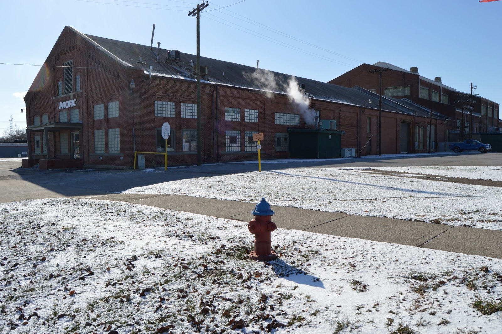
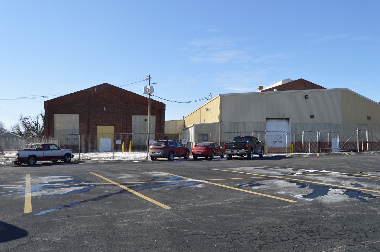
When I had compared an old aerial photo with a satellite image, it appeared that
a company had kept some of the old Big Four railyard buildings and added on to them. I was right. They must have been some sort of backshop because the building is too big for a freight house. The ground was snow covered, so I did not even bother to look for
remnants of the roundhouse foundation north of the Burger King parking lot.
I moved from the north side of the building to the southeast side of the building.
I tried going in to ask if they knew the history of the building, but the door was locked. I was not surprised since it was a Saturday.
A view of the West side. Note that the rail service has not been removed!
This "tower" is the reason I had walked to where I got the above "west view." This tower is in the satellite image and it is in the 1938 aerial photo.
The rest of the building did not look like much. Our van is parked at 7th and Belmont and I'm facing south.
I think I was seeing a coal mine on the other side of that tree line.
Indeed it was
a coal mine.
I took this shot because of the two round buildings. They are too new to be round barns. They are not steel grain bins. Later, looking at Google, it is
Wabash Valley Services Co. So they are probably storing some sort of fertilizer.
It looks like a really long ground-storage facility.
A satellite image agrees.
An Argo/New Holland dealer
The boss not only gave me permission to take pictures, he took me on a tour of the insides of the buildings to show me the rear-tracked tractor and the combines. The place started as an Allis-Chalmers dealership in 1952. I grabbed pictures of some of the A-C tractors they were fixing as we walked through the buildings. And any Massey-Ferguson tractors I saw because I think this is the first time I have seen some in Illinois.
He explained that the Gleaner combines were all the same size but the bigger model numbers had more horsepower and more capacity.
When I mentioned "axial-flow," he kinda cringed. He said the New Hollands are longitudinal, but the Gleaners are still transverse.
It struck me that the displays in the show room show what breaks or wears the most.
Since the boss spent so much time with me, the man at the counter spent time with me also. We discussed how much bigger the drawbar pins are now. When I was driving tractors, they were about a half-inch in diameter and 6" long. He said they are not only bigger, they are made from "Grade 8" steel. He looked up the price of the 36" track for for the T9 to confirm it was $15,000. So to change the rubber on the tractor would cost $100k. No wonder bloggers worry about travel on a road causing track wear. He said 20mph used to be the practical limit until they added a front suspensions. Now they can do 30mph. The problem was that they would start to "hop" without the suspension.
Then I went outside and took pictures.
(
Facebooked)
He gave me permission to take some brochures. I noticed that he had New Holland round and little square brochures, but no big square brochure. He had at least three round balers in stock. The cover was up on one of the round balers, so I took a detail shot.
This is not the only green I saw in the used machine lot. Some farmers are no longer "true green."
Kinzie was one of the signs he had by the road. These are bin-per-row planters.
He carries two different brands of augers.
The evolution of Sunshine tillage equipment from right to left.
In addition to the above big augers for filling bins, here are some small ones for emptying or transferring grain.
An overall shot as I crossed back to the south part of the property.
I think he had more Allis-Chalmers tractors than Massey-Ferguson on site. Partly because A-C tractors were in for repair. He had only one old M-F tractor.
The bin-per row planters were on the north part of the property. These air-flow planters were on the south side. I assume Kinzie makes both models because the air-flow is easier to use but costs more.
I grabed a shot of the CaseIH dealer, which is on the north side of town.
I checked out the CGB elevator in Olney. It was not loading any hoppers.
I got pictures of the old shoe factory from the CSX/B&O side and...
...I parked to get the front side.
Lots of fertilizer tanks. Actually, there was another big group of them on the other side of the building that I missed. (
Effingham Equity)
Newton Power Plant plumes. It looks like only one of the three units is running. The owner is talking bankruptcy.
The IC's abandoned
Peoria, Decatur & Evansville trestle is much more visible than it used to be.
For the number of times I have taken IL-130 through Newton, I'm surprised that I had never noticed the
New Holland dealer before. Looking at satellite images and streetviews, he never had big tractors before. But he had them when I drove through. But I almost missed them because he had them parked in the back. Most dealers put their big tractors up front as bragging rights.
I drove to the back of his south lot for a closer look. New Holland does not put their model number near the front of the tractor like other brands do. They put it in a hard to find and read spot up by the cab. But I remember seeing T9. This picture has seven big tractors.
And this picture has at least six more. I thought the farmers were still supposed to be in a recession because the price of corn is so low because we have had three years of bumper crops. This is probably the richest tractor inventory I have seen. He did not have any combines.
An overview of the lot on the north side.
Two big round tanks in what appears to be the middle of nowhere.
So I can find the tanks later. It is
Koch Nitrogen.
These hoppers were just setting on
the bridge.
It is blurry, but I remember it was a northbound local with an engine, an empty bulkhead flatcar and a tank car.
I missed the close mile market but got the next one. So the local was around mile marker 264. So the local must have been south of Loda.
Then I saw a northbound freight train south of Onarga. A freight train on the other side of a field is like ripples in the water --- it is easy to see in person because of the motion but hard to get on camera. I must have been running out of light because these pictures are rather blurry.


No comments:
Post a Comment