This blog helps me write http://industrialscenery.blogspot.com/. For example, it contains photo dumps of field trips with some text so that I can search the photos later. It is not intended to be read by others. But if you find photos organized by geography interesting, then enjoy.
Saturday, July 29, 2017
20170725 High Flows for Des Plaines and Fox Rivers
There were heavy rains in Southern Wisconsin and Northern Illinois. Some places in Wisconsin received 8" in one day! There was flooding in Northern Illinois of the Des Plaines and Fox Rivers, Some towns set new flood records. Then there were several days of more thunderstorms. I figured that rain has probably worked its way downstream so I took a trip to check the Des Plaines in Lemont and Brandon Road where I have taken pictures before. Then I took US-30 up to Aurora to check a dam I already have pictures for. and discovered the dam in Montgomery on the way.
Shots from breaks in the tree line along Canal Bank Road. Some include the BNSF/Santa Fe Bridge.
Water was flowing from the river over the Canal Bank Road and to the Chicago Sanitary and Ship Canal.
Looking upstream on the Des Plaines from Old Lemont Road. Note the BNSF/Santa Fe Bridge under the beam of the high bridge.
Northwest of the Old Lemont Road near where it joins Lemont Road. I've never noticed water here before. This is Cook County Forest Preserve land doing its job of preserving a wetland. There is a flood plane in Des Planes that has pictures of flooded homes every time we have heavy rains.
Note the water peaking out on the left.
2014o820 oo69
I took a closer look at a picture I took about three years ago. I now see that this is a natural wetland because I see a little water peaking through the weeds on the left. But you do have to look harder because the water is not as high.
This power line access road to the west is normally dry.
The power line access road to the east is also normally dry.
A wetland on a flood plane doing its job of retaining excess water in the river.
Another shot to the west from the Veterans Memorial Trail. I'll have to look through my old pictures to see if this area is normally dry. (I didn't get this particular view in 2014.)
This view is the downstream side from the north side of the Veterans Memorial Trail Bridge over the river.
\
Views from the Veterans Memorial Trail Bridge:
Upstream
Under I-355
Downstream
Looking across the Asian Carp barrier at some towboats.
Hieght of the Des Plaines River under the trail bridge.
I have left the Lemont area, I'm on my way to Dellwood Park Dam. Some construction along Joliet Road between Bluff and 135th.
I set the camera to 18mm and held it at arms length and blindly took these shots as I crossed the various 135th Street bridges across parts of the Des Plaines River from west to east.
An Amtrak train on the CN/GM&O is stopping traffic ahead.
The above photo cropped
It must have been going quite slow because I'm catching it on New Ave even though it had the head start of me going through the traffic light and the traffic is doing around 50mph. Again, I'm just holding up the camera and hoping the train is somewhere in the frame.
Passed it by. Later on this road it must have sped up because it passed me.
It was a very short red light. Since I had to wait another cycle, I took a picture of downtown Lockport since I did not push the yellow light and there were no cars in front of me. It still has a lot of 1800's architecture buildings. And focusing on the photo helped calm by road rage of being caught by a short green light.
I took more pictures of the Dellwood Park Dam and CN/GM&O culverts. I needed more pictures of this dam because when I started to write a posting on it, I discovered the pictures I had taken did not have good views. And this pictures catch it with a strong flow in the creek Fraction Run.
I retook the historic picture on the sign because the one I had taken had some bad glare.
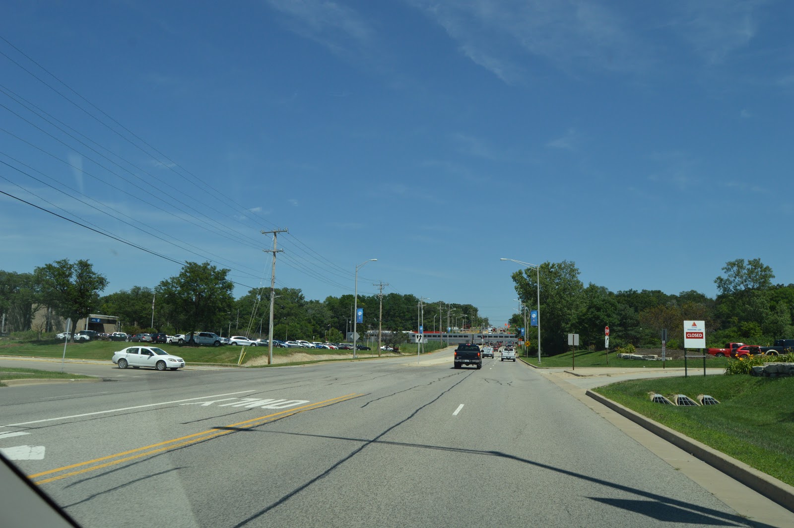
Now I'm on my way to Brandon Dam. This is where US-52 turns right onto IL-53 to go north to I-80. Notice the light is green, but we are not turning to the right. There is a truck in the other lane also. I had noticed that about every fourth vehicle going north on IL-53 was a trailer-truck. That is because of the relatively new intermodal yards they built on the old Joliet Arsenal land. This intersection took multiple traffic light cycles to get through. So my policy of normally doing field trips during the weekend in urban areas has been validated. But I was afraid the river levels would be significantly lower by the next weekend.
The next photo shows why they have the BRIDGE CLOSED AHEAD sign.
I recorded the end of the train to record how slow it was going.
I first stopped at the end of fixed bridge so I could walk back to get pictures of the dam and river. But thanks to the cheapness of digital photography, I grabbed this view of why the road was closed.
Normally some of these views have more islands in the river.
You can see ripples in the water in the photo because the flow is heavy enough to have turbulence, but I took a video to record the speed of the flow. I could safely walk from one side of the bridge to the other since the road is closed.
Then I drove down to the drawbridge to see what they were doing. They were doing nothing except screw up traffic by having the bridge out of service.
Catching where the Mantowic 777 is located this visit. The boom is just to the right of the trunk of the big tree.
I took this photo just as the gate was finishing opening. (The gates are quite. I had no clue that they were opening while I was taking the above picture of the bridge until I happened to glance that way.)
Another shot of the crane. A worker is removing the rope from the floating tie-up.
A couple of workers are now at the corner of the barge. And I'm trying to patiently wait for it to move...
...so that I can take a video of it leaving the lock and going past the bridge.
I did an experiment of videoing a southbound (timecard westbound) intermodal train. Unlike photos, you cannot get the engine numbers from a video. You could tell it was pulled by two engines and it had some CMA CGM containers. So it was an international container train. I did not upload this video to You Tube since you can barely see the train.
While I was watching the train, the lock gates had closed.
I then tried going west on 4th Ave to cross the Des Plaines since a could not cross the river on Brandon Road. But this truck evidently decided he could not go under the overpass after he had 4th Ave blocked. We all ended up turning around and going the other way. I ended up taking US-30 across the river.
As many 18-wheelers as passenger cars. Intermodal traffic reduces pollution in the country where it is not a problem, but it increases pollution in urban areas where it is a problem.
Trail bridge under the US-30 bridge across the Fox River. My plan was to head north on IL-25, but I discovered that I drove right over IL-25. So I explored the west side of the river. I'm glad I did. I discovered this Fox River Trail Bridge.
Looking upstream from the trail bridge. Note the water is up to the seat of a riverside bench.
After walking further along the bridge, I took an upstream photo to catch the debris caught by the second pier.
A wide angle upstream shot.
There was water on the island that the bridge goes over. I wonder if this area is normally dry.
Looking upstream on the east side of the river.
And downstream.
Zooming in on the railroad bridge I spotted. I see there is the top of a crane boom as well. The bridge is for the IR/BNSF/CB&Q/ OO&FR branch that goes to Streator.
More water on the island.
First of all, this big US-30 overpass is for a road that goes nowhere. Secondly, it was made with steel girders instead of concrete beams. That has become rare for road overpasses.
(over)built 2000 by the State of Illinois.
Using my Garmen in map mode, I found the next crossing to the north to get me back on the east side of the river. Unlike a street view, the plantings were pretty. Maybe because they now have sponsers.
I generally have better luck taking blind pictures to the right of the van than I do to the left.
Fortunately, after I got across the bridge, there was a trail head parking lot so that I could stop and check out what looked like a dam from the bridge. This shot is recording how high the river is on the bank.
A picture of the Mill Street Bridge and the turbulence of the water.
The upstream view from about the same position.
Shoot early and often? (This is redundant.)
This picture shows the hill that is between the river and River Road. My van gives it scale. Some government agent has done its job of not allowing development on the low lands and maintaining them as park land so that they can do their job of being a flood plain.
Note that there are two debris lines along the bank. So the river had two higher crests.
There was a sign on the trail by the parking lot indicating the trail was closed. But I went anyway to check out the river level. When the river was at its peak level, the trail would have been rather wet.
(Xavier Quintana posted some pictures of the river near its crest.).
But I just walked further from the river where the land was higher. But I had changed from my regular shoes to the "mud shoes" I keep in the van for field trips. Note some trees and bushes are still in the water.
I did not realize it at this time, but we are seeing debris that has been washed up quite a ways by the former crests because this area is so flat by the river.
There were quite a few fisherman along the shore up by the dam's turbulence. Also note the fat debris line left here.
As I passed what probably used to be a tailrace, I took a picture of it to record the river's level. When I visit this dam later during a normal flow rate, I'll have to take a comparable shot to see what is normal.
I was shocked to see waves of hydraulic jumps. I have never seen that before, not even in a photo.
I find watching turbulence, whether it be a real log fire in a fireplace or heavy flowing water, to be mesmerizing.
Looking downstream from the dam at the trees that were in the bank shots I took above.
Waking back to the van is when I realized the logs and stuff on the land to the left was because it had been covered by water.
Another debris line. This one crossed the trail.
The entrance to Hurds Island was closed so I ended up parking in a lot north of North Ave. off of River Street. I first went to the bank to get some shots of west side of North Ave.ue Bridge from the upstream side.
Another view of the upstream side closer to the bridge.
And turning to get another view of the railroad bridge.
Looking downstream from the west side of the North Ave Bridge
"Park Temporarily CLOSED" The playground areas were still flooded. But the trail is built on an embankment.
Part of the parking lot is still under water.
The eastern BNSF/CB&Q bridge.
An intermodal train is coming and there were a lot of geese on the island. You had to be careful where you stepped on the trail because of the droppings. And some places along the trail had a rather distinctive odor.
Too bad I centered the train in the frame. If I had the train nearer the top, we would have seen more of the river flow.
More containers
After I walked further down the trail, I turned to take a picture of more containers.
Then I noticed that there is a clearing in the trees so that you can see some of the bridge...
...so I zoomed in on that. I was also catching the MAERSK name. I believe that means this is an international container train.
The ducks are loving the river out of its banks.
A speed limit for bikes.
The concrete extensions of the piers that we normally see are under water.
Note the (lack of) clearance under the trail bridge as well.
Views of the bridge are limited because of a treeline along the shore.
Walking back, another view of the river at the top of its bank.
Some baby geese by the trail. I was careful to walk on the far side of the trail. But I was surprised that they let me get this close without reacting.
Another view of the gaggle.
Another view of the flooded parking lot and several trees in the water.
This is west of the river and south of North Ave. as I walked back to the van. I was particularly interested in the pile driver. I wonder why they felt they had to put up the black view block.
I'm glad someone was parked on Galena, otherwise I would not realize I could park right by the dam. This was taken from the van to record my neat parking space.
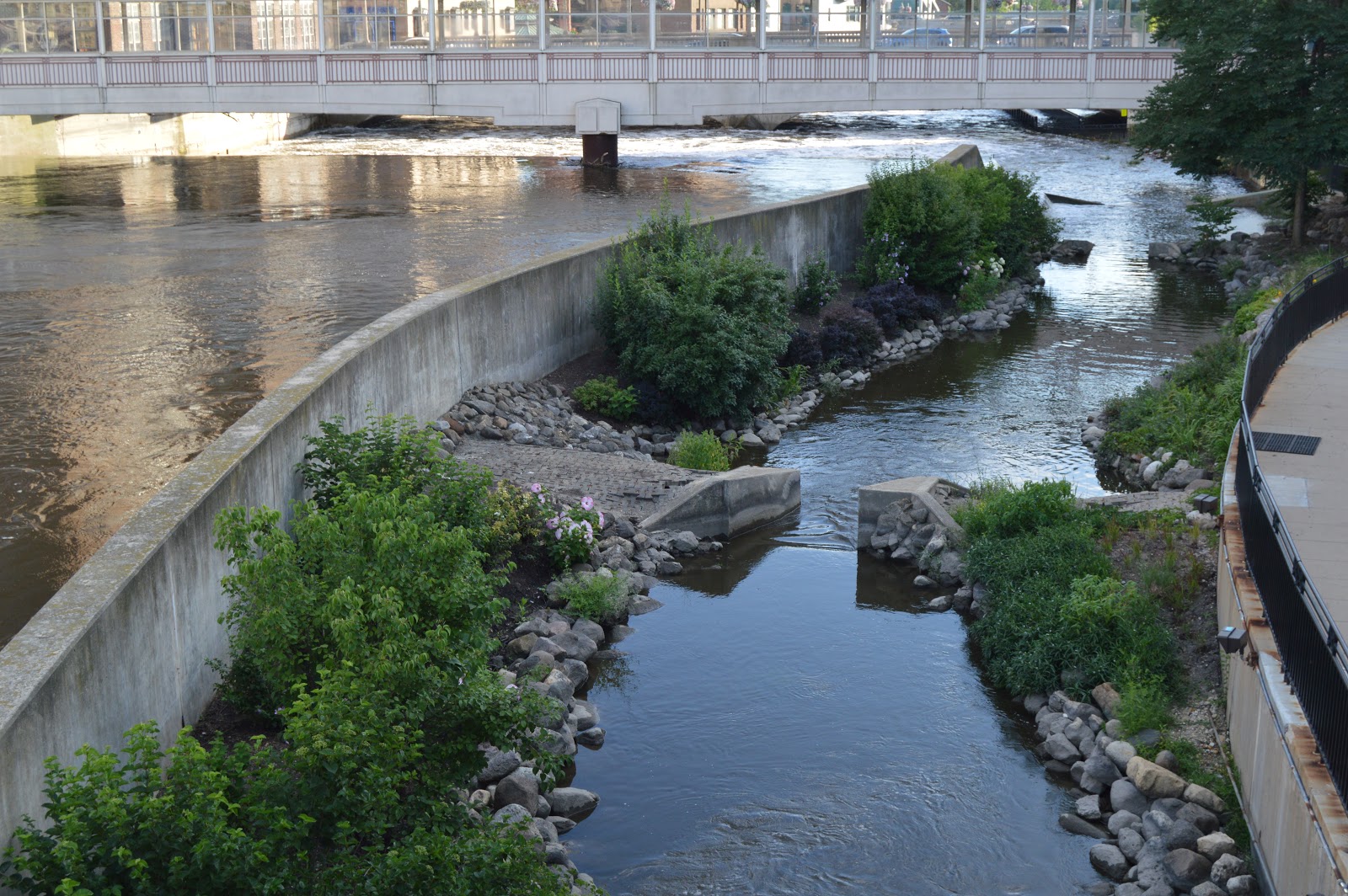
A shot from the bridge. A lot of the canoe chute is under water.
After going down to the trail, you can see it is under water under the bridge.
Taking shots as I walk up the trail past the canoe chute.
And a shot facing downstream.
A picture of the east side of Galena Bridge from the New York Bridge.
Looking upstream from the east side of the New York Bridge.
A big log was trapped by the roll of the water.
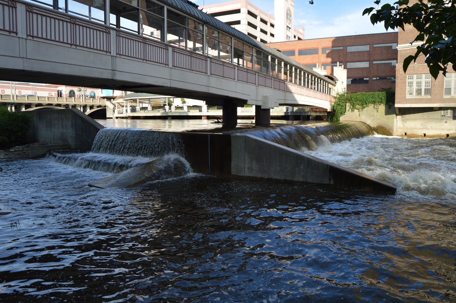
An overview of the flow over the dam.
An overview of the downstream turbulence.
Downstream side of the east part of the New York Bridge.
Closeup of dam flow.
Overview of dam flow.
I noticed that the river is getting kinda close to the patios of the Hollywood Casino.
More views of the west side dam as I walked back to the van.
I'm checking out the action at Ohio Street overpass. This international container trains was just setting there.
An eastbound headlight and westbound commuter.
Since the eastbound train has piggyback trailers, it is a domestic intermodal train.
As the domestic train arrived, the international one started moving.
Yet another commuter arriving in Aurora.
This was the same international container train I saw while on Hurds Island. Considering the amount of time I took to take pictures of the dam, I wonder who could not accept the train from BNSF and forced it to wait.
By the time I got back off the bridge, the train had stopped.
Note that the same CHINA SHIPPING container is in both of these photos.
By the time I got to the west end of Eola Yard to check out the construction, the domestic train was probably gone and the international one was rolling through.
It looks like BNSF is switching from wood to concrete ties somewhere.
There were two cuts of concrete tie cars in the new yard.
I walked to the No Trespassing sign to get a picture of the tie gantry. They are not storing those cars here, it looks like they are using them to lay new track in the yard. But why did they use wood ties for what has been layed?
The drainage ditch that is on the other side of the access road that I was on.
I found a gap in the two concrete tie blocks so that I could wait for a gap in the intermodal so that I could record that another commuter train was coming through.
Our MAERSK friends that we saw on Hurds Island, at Ohio Street and now Eola.
I wanted to get a clear view of SEALAND.
These are photos I found on Facebook to help document the 2017 flood.


No comments:
Post a Comment