My daughter and I went to the
Oil & Gas Musuem in Parkersburg, WV. We also went out along the river front to get pictures of the bridges.
 |
| 20171013 |
The GPS took us across the Ohio River on
the Blennerhassett Island Bridge.
The side of the Oil & Gas Museum building has a mural and their side lot is full of old oil drilling and pumping equipment.
They show a video that explains that they feel that West Virginia, not Pennsylvania, had the first oil well. There was a ridge along which drillers would find oil just 25 to 50 feet deep because it was on top of an anticline oil reservoir. The video also explained that Abraham Lincoln was relunctunt to sign a bill that would split Virginia because he was fighting a war to avoid spliting the USA. But he was pursuaded the day before the deadline to sign the bill.
This was the largest machine on display. A self-powered drilling rig.
There were many heavy industries that built equipment for oil drilling and production.
An exhibit on the two railroads that supported the area --- Northwestern Virginnia and the Baltimore & Ohio. (Later I learned that the Northwestern Virginnia became a subsidiary of the B&O.)
This is the label next to the following device. I did not see the catalogue mentioned in the label.
A 12x12 steam engine.
When I saw the blue "
Wayne" nameplate below the glass plate, I had to take a picture. The label at the bottom is a reminder that lead was added to gas to increase its octane until about the 1970s when it was determined that lead was toxic to humans.
An even older gas pump. I believe you used the lever on the side to pump the gas up into the glass measuring compartment. Then when you had the desired amount, you opened up the nozzel on the delivery hose and gravity fed the gas to the car.
The same basic design of a pump, but for a station carrying a different brand.
We will see that their collection is not limited to oil and gas relics. They had entire rooms on the Civil and World Wars that I did not even photograph because I'm not a war enthusiest. But this old switchboard is an important part of telephone history.
This is part of the preserved room of the old hardware store.
When I first wanted a photo of an old typewriter, it was months before I found a typewriter of which I could take a picture. This one room has more typewriters and calculating machines than I have seen in all of the museums I have visted the last three years, combined.
This is the other side of the room. Note the lader that hangs from an overhead rail so that it can be moved along the wall to access the high shelves. With all of those jars, this looks more like an old drug store. I remember hardware stores would have the wall full of little drawers, each of which would hold specific sizes of screws, bolts, washers, etc.
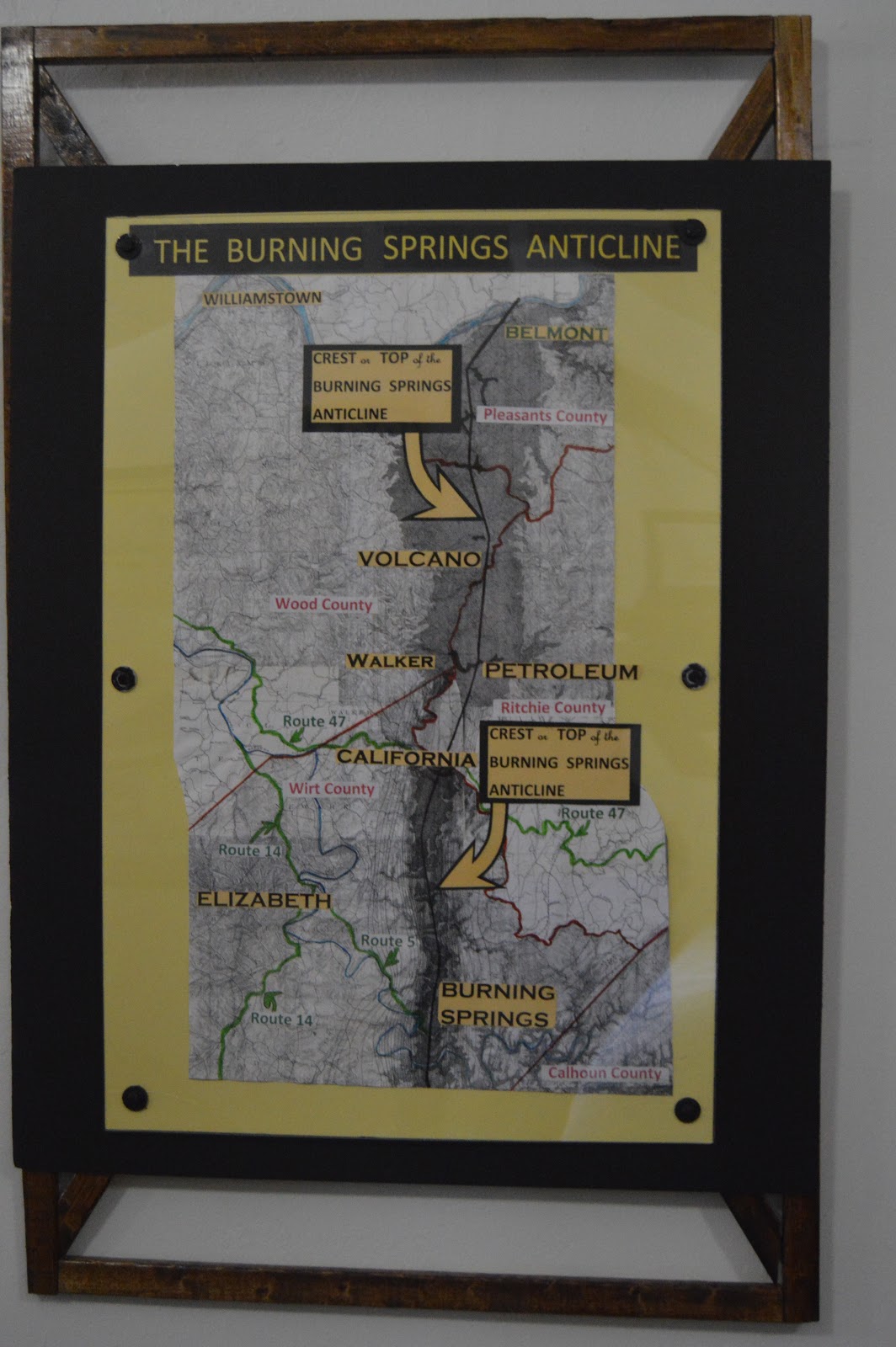
A map of the ridge that produced, in today's dollars, billions of dollars of oil.
It is an upward thrust of the rock formations that bend them into an arch that causes the oil and gas to be so close to the surface. The boom in this area was before the civil war. The two men that discovered the oil were drilling for salt deposts, but found oil instead.
Tucked away in a corner of the hardware store part is this typewriter with a really wide paper carriage. And some necissities in any office --- coffee mugs.
When I noticed the Toldeo scale at one end of the room, I went to the other end and took a picture along the wall with the ladder. The skylight is a reminder that this building existed long before the electric lighting was common.
The room that had the above wall exhibit on the railroads also had a couple of models of steamboats in the middle of the room.
Then we went down into the basement.
This gas engine is in the process of being restored.
A flywheel that is so old the wheel is made with wood. It is the width of the room, about fourteen feet.
Most of their old gas engines are in the basement.
My daughter noticed that the blue engine by the stairs is a
Fairbanks-Morse engine, so I had to get a closeup of it. Some photos taken in the basement are blurry because, even at ISO 3200, the shutter speed was sometimes rather slow. (I checked the metadata, this one was 1/4 second. )
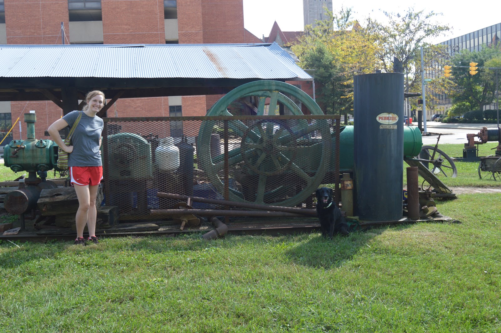
My daughter, Karen, was happy with the museum because they allowed her to take her dog, Dixie, inside.
It quickly occurred to me that fishing did not mean getting a fish out of water but getting a broken pipe back up out of a well hole.
This is the end of a drill pipe setting upside down. The label with this exhibit read:
REMNANTS OF A DOWN HOLE FIRE
On August 26, 1993 while drilling at approximately 1555' using air w/ soap-mist for a circulating medium (to clean cuttings out of hole ahead of bit) they encountered just the proper amount of oil and/or gas that mixed with the air caused a down hole fire/explosion. The bit and burned up bottom hole collar displayed are the result of the down hole fire/explosion.
Down hole fires while drilling with air are not that unusual, however getting the results out of the hole is very unusual, as normally all you recover is the burned off end of the drill collar.
Name of the well was - CNR (Columbia Natural Resources) Public Land #22675.
One room is essentially a preserved grocery store. What caught my eye was the cash register and coffee grinder. But after uploading the photo, I see I also caught an old-fashioned telephone on the left side of the photo.
Another room had household items such as this
Singer sewing machine. This is another demonstration of why Singer opened a plant in South Bend, IN to make the cabinets from the hardwood trees that were abundant in Indiana before the land was cleared for farming. On the leftside of the sewing surface is a record that can be played on the old record player to the left.
A picture of the record player. You can see the hand crank on the side. I regret that I did not get a closeup of the part with the record.
I think this is a coal-fired cooking stove.
They had some trunks on display. This is what I think of when I read that someone shipped their stuff in a trunk.
Someone involved with the museum has an interest in old typewriters and calculating machines because here is another collection in one of the "nooks" of the museum.
Vitrolite was a brand of
pigmented structural glass. I don't think of oil when I think of West Virginia, but I do think of glass.
Evidently Vitro Agate made marbles.
Karen spotted this Teletype machine. Since this is the first one I have seen in persion that had a keyboard, I backtracked to get a photo of it. (I worked at Bell Labs and we had ROP Teletypes in some of our labs. Many memos defined ROP as Read-Only Printer. They were wrong. For a Teletype, ROP means Receive-Only Printer. That is, it is a Teletype without a keyboard and transmit equipment.)
Another reminder that West Virginia made glass. In this case it is ceramics for electric power insulators.
I knew that Ames was in Massachusettes and made the shovels, picks, etc. needed to help build the transcontinental railroad. I was not aware that they had a plant in West Virgina.
Most of what is in this display case, I have seen before. But I had to get a picture of the five-handled spade used for ground-breaking cerimonies so that five guys can grin and help move the first hunk of dirt for the photo op. (I say guys because I don't remember ever seeing a woman weilding a shovel in a ground-break photo op.)
Not only does this display capture some old boats on the river, it captures some old bridges.
A display of some devices that automatically oiled bearings in steam and gas engines.
A model of one of the early drilling rigs.
I could not find a brand on this tractor. It had a crank for starting in the front. But it looks like an electric starter was retrofitted. What makes it different from the many old tractors I have seen at farm shows is that it has a wench permanently mounted on its rear.
In today's world, we have to worry about whether or not we are going to update our Facebook profile picture.
The front of the museum. I wish their web site had the information that there are reserved parking spots right in front of the door for free parking for visitors. All of the spots in the parking lot behind the building were reserved.
We then walked a block towards the river and a block downstream. This photo records the elevated railroad approach to
the bridge over the Little Kanawha River and, in the middle background, the hole in the flood wall to the left of the SUV.
This sign indicates that the Northwestern Virginia Railroad was a branch of the Baltimore & Ohio Railroad.
My motivation for walking
to the riverfront was getting pictures of the bridges. From downstream, the articulated road bridge obscures
the B&O Bridge.
They have painted their floodwall so boats docking at the riverfront know where they are at.
As I had hoped, I could get a decent shot of the bridge over the Little Kanawha River from
Point Park.
Even with the lens at 18mm, it took a couple of pictures to get all of the bridge.
There were people setting on these "steps" fishing. Note the step that Karen is on is dry, but the next one has water on it. The locals said that one and the next one are usually dry. And sometimes you can see another step.
In this satellite image, you can see the second level is dry and the third level is barely covered. I checked Bing's satellite view and discovered that the resolution was not near as good as Google's image. It was hard to tell which steps were covered in the Bing aerial.
When I checked the Birds-Eye View, I discovered that this riverfront park was constructed rather recently.

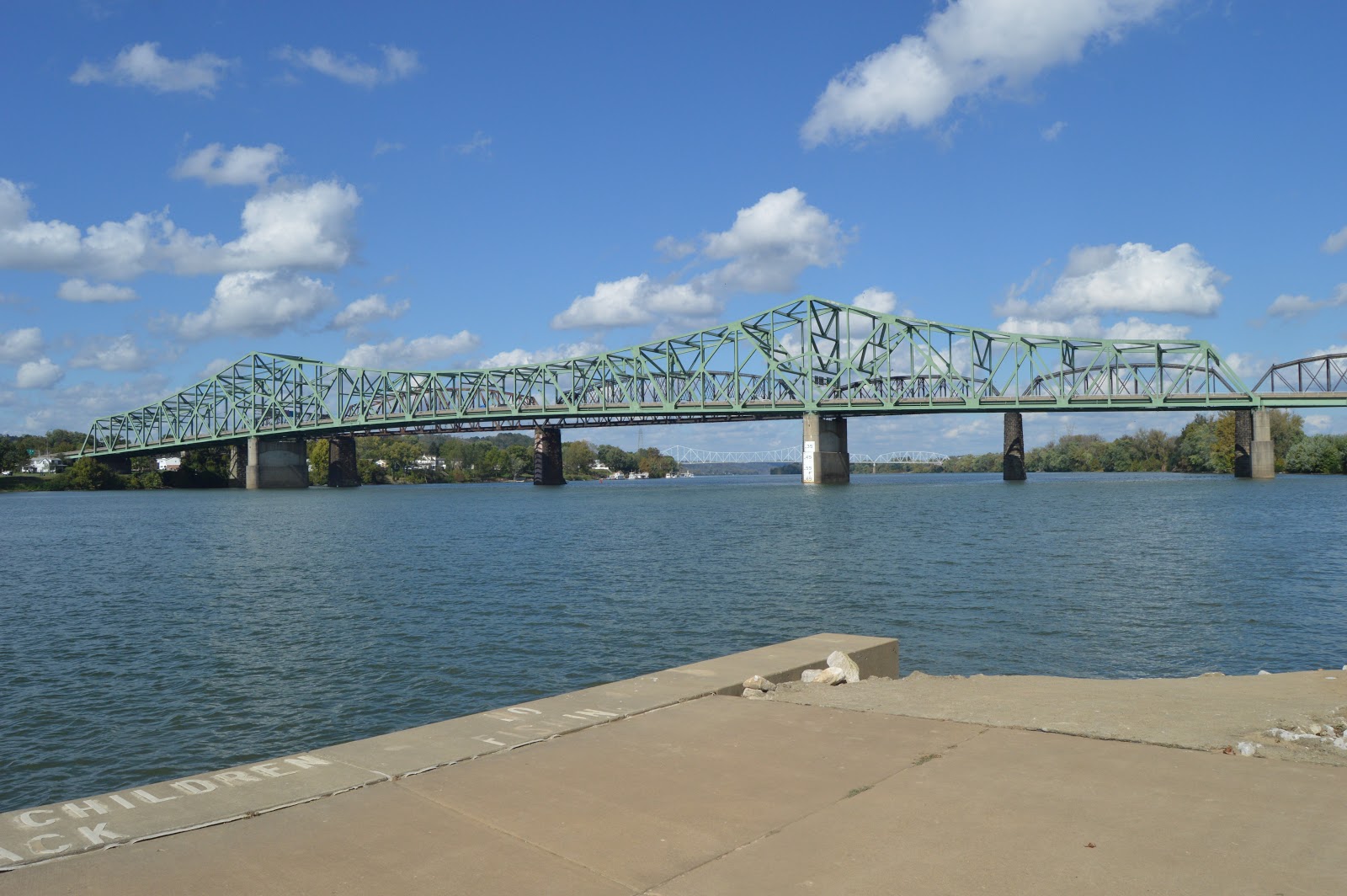
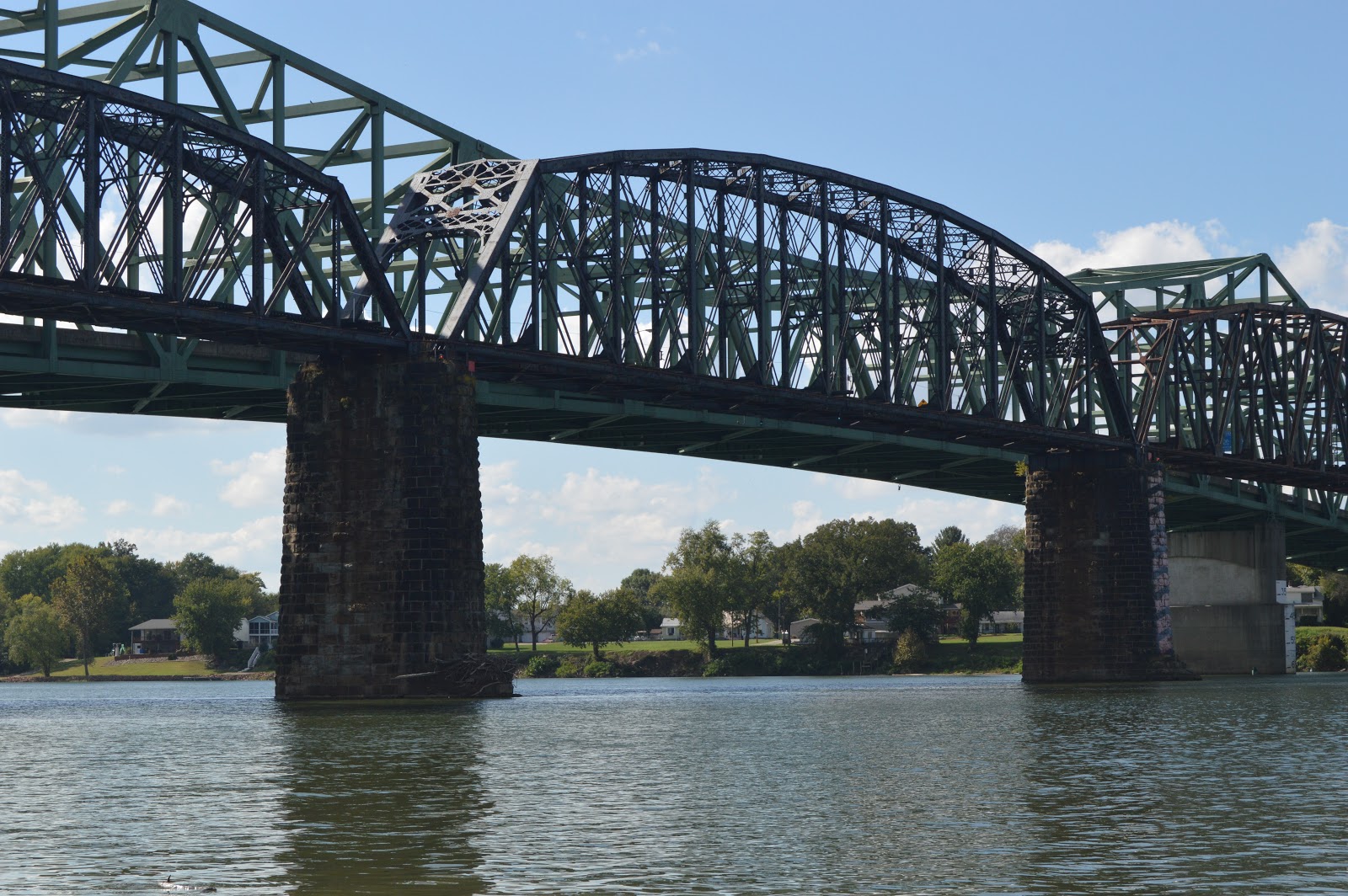
A view of the
road and
CSX/B&O bridges across the Ohio from the Point Park.
I took more pictures of the bridges as I walked upstream to get shots of the railroad bridge from the upstream side.
As I walked, I took more pictures because I was bored and because I have learned that with complicated trusses you can sometimes see something in one angle that you can't see as easily in another angle.
At the end of the seawall...
...a sign indicated that this trail went to a "designated fishing area." This photo shows the trail along the flood wall and
an outlet structure.
Obviously, the road bridge is on the left and the CSX/B&O bridge is on the right. You can tell the railroad bridge is old because it has cut-stone piers and pin connected tiebars for the bottom chord.
Focussing on the railroad bridge. I normally don't slant my vertical shots when I'm standing straight up. I'll have to rotate and crop this for
the Industrial History blog.
I got off the trail and walked up the embankment to the flood wall...
...so that I could see the bridge over the trees as much as possible.
You can tell the two navigation spans are longer because their trusses are deeper.
I'm at the end of the trail, and I did not see a "designated fishing spot" that would have removed the trees that were blocking my view of the bridges. But going back I encountered a guy carrying a fishing pole who had, I'm guessing, a 6-year old son with him. I mentioned the sign about a fishing spot. He said he hadn't been here for a while. When he was here last, there were no trees along the shore. He explained the concrete structure in this photo was a spillway and you used to be able to fish in it. But it looks brush filled and
a satellite image confirms that.
Then he spotted a "path" through the trees. I put path in quotes because it was not much of a path. I would not have spotted it. But we were able to get to a little strip of dirt along the river bank that was not muddy. (I carry tennis shoes in the van for field trips that I'm willing to throw away if they get muddy. But I keep forgetting to change to them before I go picture hunting.)
It was hard enough to get here that I was in "shoot early and often" mode.
I did not have a clear view of the
Memorial Toll Bridge that was upstream. But I was able to get the Ohio side which was hidden in the other pictures I took of this bridge.
Going back to the trail, it occurred to me to record the wilderness nature of the "path."
This captures the width of the road bridge and the other side of
the big concrete structure that I walked by earlier.
This time I noticed a sign indicating that the outlet I shot earlier was an "outfall." I still don't know if the big concrete structure is a pumping station for when the flood gate is closed and this is the outlet of the pumps. If so, that would indicate that it is important for the pumps to pump against a consistent head of water. But I suspect it is the end of a storm sewer that runs from someplace further inland that is higher than the height of the outlet.
I found a gap between the piers of the two closer bridges to get most of
the upstream road bridge.
I had my daughter walk ahead of me to provide some scale for the height of the flood wall. Soon before we headed back, I explained to Karen that if I was a true railfan I would wait hours in hopes that a train would cross the bridge. Then we heard the bell of a locomotive! After waiting a while with the camera ready, I concluded the locomotive was on the grade line that ran along the other side of the flood wall. There was no way I could run all the way back to the hole in the wall and then back here to get a picture of the train, so I didn't bother.
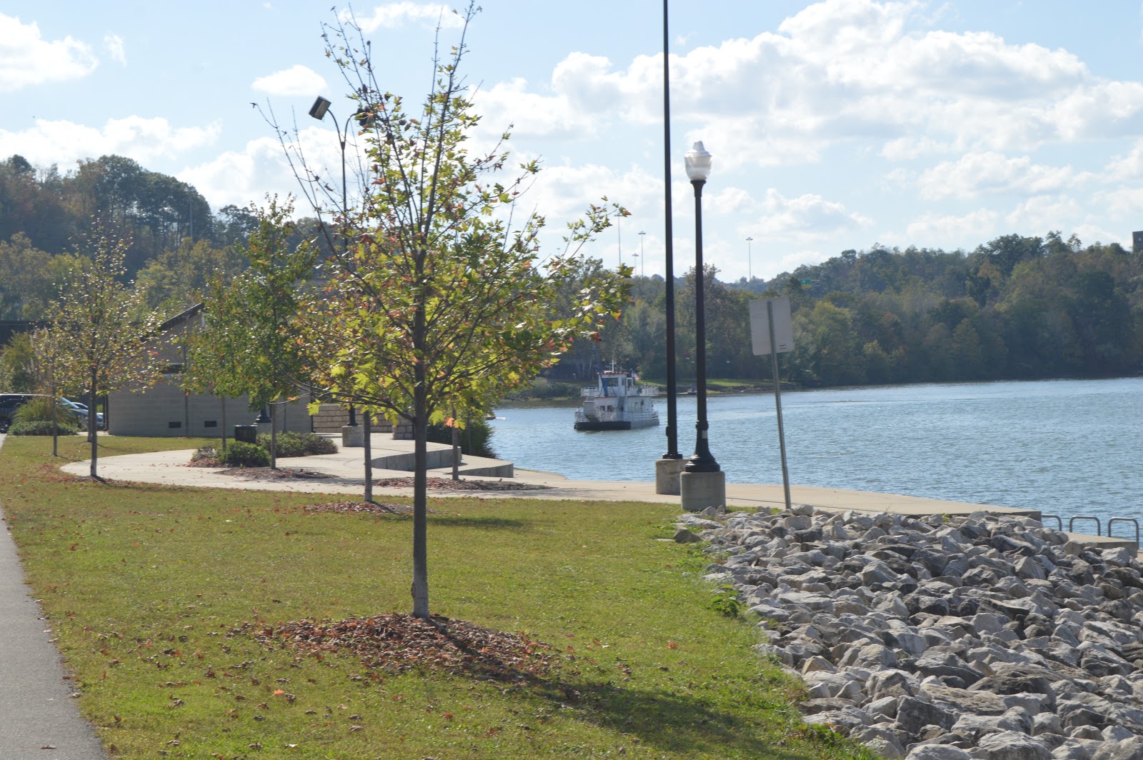
As we walked back to the access hole, a stern wheeler approached the docking area.
It was still unloading when I got closer to it. Karen talked to one of the people that disembarked and confirmed that it takes people over to
Biennerhassett Island. The person explained that the trip includes a tour of the mansion and carriage rides.
We have just gone through the hole in the flood wall. These would be the tracks that had the locmotive we heard.
This is looking towards the river along 3rd Street from Ann Street. The diner we ate at is just to the left. On Google Maps it is labeled as a car dealer. So the diner is obviously rather recent. The railroad overpass and embankment is part of the approach to the bridge over the Little Kanawha River.
1899
I took this picture to record the use of another 4-wheel steer lift. But I learned while looking at Google Map that they tore down an old building on the corner to build this new building.
Wood County Courthouse viewed from 3rd and Juliana Streets. Again, I have lost my touch taking vertical shots and it has a little tilt. I also which I had gone further to the right. I was in a crosswalk and I was nervous about when the traffic light was going to change.
Turning around, I got an overview of the museum.
We are now on 5th Street heading to the bridge that crosses the Ohio River.
Karen took some shots as we crossed.
I commented that I did not think vertical shots made sense. But it is easy enough to crop out what I don't want.
Here you can see my finger pointing as I asked her to make sure she got some of the railroad bridge that was to our right. I was deliberately in the right lane to get a better view and so that going a little slower was proper lane usage.
And she took plenty of pictures. In this one, you can see the upstream road bridge under the railroad span. She knows that with the economics of digital photography I believe in early-and-often.
The railroad approach on the Ohio side.
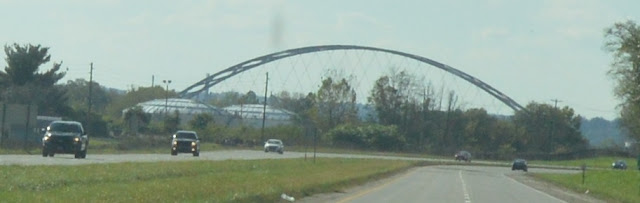
On the way back on US-50, we could see the arch of
the Blennerhassett Island Bridge in the distance.
 |
| The above with digital zooming |
As we got closer, our view of the bridge was blocked by
Kraton Polymers, but it was rather interesting in its own right.
One advantage of a DSLR is that it has enough resolution that a lot can be cropped and one still has a photo that is good enough for a blog posting.
 |
| The above with digital zooming |


 A view of the road and CSX/B&O bridges across the Ohio from the Point Park.


No comments:
Post a Comment