This blog helps me write http://industrialscenery.blogspot.com/. For example, it contains photo dumps of field trips with some text so that I can search the photos later. It is not intended to be read by others. But if you find photos organized by geography interesting, then enjoy.
Wednesday, June 13, 2018
20180610 Fox River Dams and Trail Art
I went to Kane County Fairgrounds for a railroad meet.
20180610 1440
I used the Garman GPS because I could not figure out which exit off I-88 west of the Fox River would be the best one to take. Imagine my surprise when it had me get off at IL-59. Then I remembered that if the times are comparable, Garmen avoids toll roads. It used IL-38 to go from IL-59 to Randall Road. So I got this overview shot of Geneva on my way there. Later I'll come home using IL-25 and turn back onto this street to turn into the parking lot on the right just this side of the river. They reserve some 3-hour parking spots for use of the river trail.
Coming home, I first went a little north to checkout the dam in St. Charles. Note only had it been raining, it was raining. I was holding an umbrella while taking these pictures.
There was a strong current going over the dam.
The river is wide enough that it took a couple of photos at 18mm to get the whole flow.
Upstream is the abandoned CGW Bridge and a trail bridge under it. If it was a nice day, I would have walked up the trail and gotten better photos of the bridge. I do plan to go back during drier weather.
I noticed the Reflections Statue has an explicit label on Google Maps with 15 photos. Even on a cloudy, rainy day, there are some reflections of what little light is available.
Now I'm down in Geneva at the Old Mill Park near the trail head parking lot.
A plaque on the above sculpture.
You go down a little trail from the statue to the river side. This is the west part of the dam.
This is a small, but high flow, channel on the east side. In the above photo you can see the turbulence on the right side where this channel's water enters the main channel.
The trail goes under the bridge so you don't have to contend with traffic. When I went south of the bridge to check out the disappearance of a famous restaurant, I noticed a train on the UP/C&NW bridge. So I grabbed a shot of the eastbound train. It looked like a coal train, but I have learned that the same hoppers are also used to haul petcoke to a transload to barge facility on the Calumet River.
The train was heavy enough that it had a DPU. A Distributed Power Unit is remote controlled from the head locomotive. I tried zooming in on the DPU to get its number, but, even at 1/250, it had too much motion blur to see the number.
This is the remnants of a famous restaurant that I have eaten at a couple of times. It has disappeared from the street views, but it is still in the satellite view that I captured below.
While I was south of the bridge, I took a photo of the dam framed by the arch of the bridge. You can see there are serious ripples in the current this far downstream from the dam.
On a good day, I would have walked down the trail to get photos of the UP/C&NW bridge, but it was not a good and and this is my closest shot.
When I got back up to street level, I took another picture to record the famous restaurant is gone.
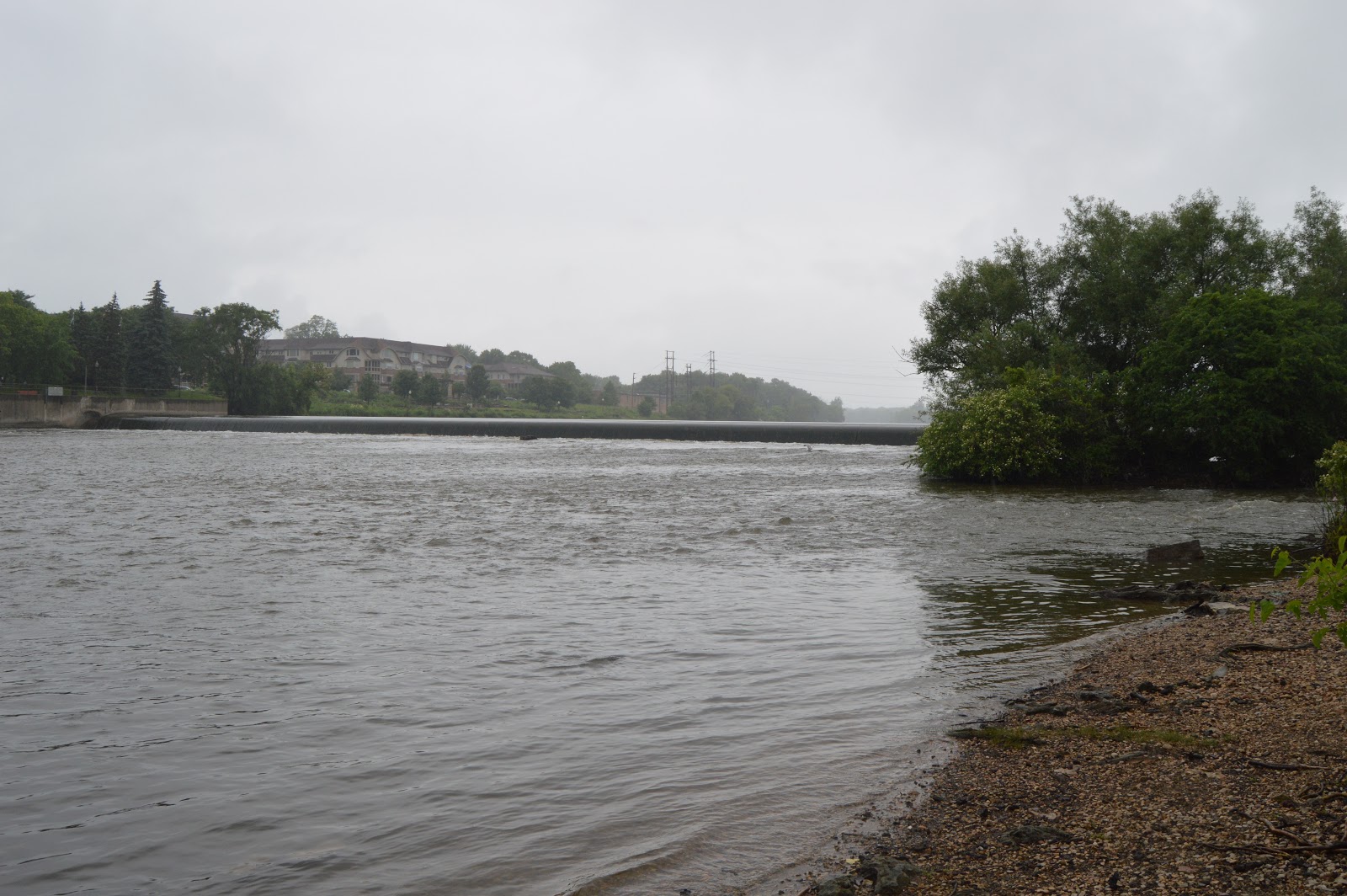
And turned and took an overview shot of the dam and the little island of trees.
I walked out on the bridge to take another overview shot. Even at 18mm, the bridge is too close to get the whole dam in one photo.
On my way back to the van, I took a shot of the sculpture from a different angle.
This shot of the windmill is not bad considering I was shooting blind after I passed it. I pulled into a parking lot just south of it, but there was a tree between me and the windmill. So this goes on the "better weather" list.
Now I'm in Batavia having walked north under the bridge from some parking spaces they have reserved as a trail head south of Wilson St. The main reason for taking it was the river level gauge carved into this pier. The water was at 656.5, whatever that means.
Looking upstream. They built the trail on a fill in the river. Note the bridge for the trail, an old electric transmission tower and a smokestack.
After climbing some stairs that take you up to the trail bridge, I took a photo of the old building across the river. There are some windmills along the river.
Looking upstream from the trail bridge, I see there is another dam and smokestack to check out some day.
Looking back downstream from the trail bridge, we see the smokestack and electric tower we saw earlier.
I then walked away from the river and back south (downstream) along the first road. Again we see the smokestack and electric tower that is in the area.
A nice view of the electric tower as I go past it.
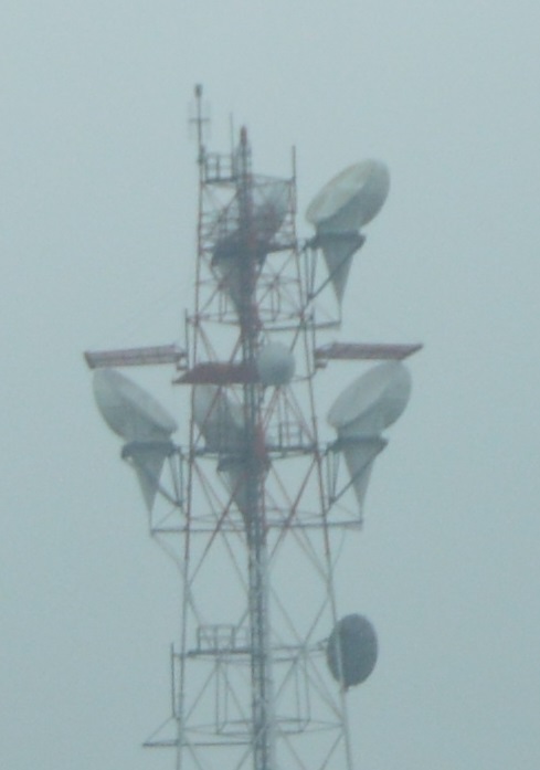
I'm on my way home now heading east on Butterfield. It is so nice to have something to take a photo of while stuck at the Eola stop light. In this case a microwave tower that still has horns attached. I wonder whose it is. There were no signs along Butterfield or labels on Google Map.


No comments:
Post a Comment